Akkar District
| Akkar District | |
|---|---|
| District | |
| عكار | |
|
Coastline | |
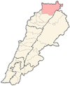 Location in Lebanon | |
| Coordinates (Halba): 34°33′02″N 036°04′41″E / 34.55056°N 36.07806°ECoordinates: 34°33′02″N 036°04′41″E / 34.55056°N 36.07806°E | |
| Country |
|
| Governorate | North Governorate |
| Capital | Halba |
| Area | |
| • Total | 788 km2 (304 sq mi) |
| Population | |
| • Total | 198,174 |
| Time zone | EST (UTC+2) |
| • Summer (DST) | +3 (UTC) |
.jpg)
Akkar (Arabic: عكار) is a district (Qadaa) in the North Governorate, Lebanon. It covers an area of 788 km2 (304 sq mi) and has a population of 198,174. The capital lies at Halba. The name Akkar is derived from the Syriac word, Akkare, meaning farmers.
The district is characterized by the presence of a relatively large coastal plain, with high mountains to the east. Akkar had been governed during the last 400 years by the Emirs and the beiks of the Merheb ( Merheb, Merhebi, Shdid, EL Ali, Othman, Kaddour etc..) family. After the civil war this was no longer the case as peasants took over the land with the aid of Syrian troops during the civil war. The largest cities in Akkar are Halba, al-Bireh (previously called "Biret el Hokem" where we find the Castle of Merheb Family), Kobayat (Quobayet).
Akkar has many important Roman and Arabic archaeological sites. One of the most famous archaeological sites and the birthplace of the Emperor Alexander Severus, is the Tell of Arqa near the town of Miniara. Several prehistoric sites were found in the Akkar plain foothills that were suggested to have been used by the Heavy Neolithic Qaraoun culture at the dawn of the Neolithic revolution.[1][2]
The district only news agency is Sada Akkar, a local bi-weekly newspaper with an online website updated daily with the latest news from the region. The news agency focuses on social, economical and cultural news with less emphasis on the political news from the area, in attempt to reach a broader audience.
Demographics
The residents of the Akkar District are predominately Sunni Muslims followed by Greek Orthodox Christians. Maronites are the second largest Christian denomination, and have typically resided around the city of Kobayat. This region is also home to the largest population of Alawites in Lebanon. Melkite or Greek Catholics are also present in small numbers in the region. In total, it is estimated that approximately 70% of the population is of the Muslim sect, whereas the remaining 30% is of the Christian sect.
Due to poverty in the district and other factors, many people from here have taken to paying people smugglers to bring them via a dangerous journey by boat to seek asylum in Australia. This journey often ends in deaths as the boats capsize in the dangerous Indian Ocean. [3]
References
- ↑ L. Copeland; P. Wescombe (1966). Inventory of Stone-Age Sites in Lebanon: North, South and East-Central Lebanon, pp. 20-21. Impr. Catholique. Retrieved 3 March 2011.
- ↑ Wetzel, R. & Haller, J., Le Quarternaire de la région de Tripoli. Notes et Mémoires de la Délégation Générale de France au Liban. Section Géologique, No. 4. Beirut, 1945.
- ↑ 29 Lebanese missing after asylum boat sinks off Java, AFP, September 29, 2013
External links
- Sada Akkar News site - Specializing in news from the district of Akkar
| |||||||||||||
| ||||||||||||||||||||||||||||