Akiruno, Tokyo
| Akiruno あきる野市 | ||
|---|---|---|
| City | ||
|
Akiruno City Hall | ||
| ||
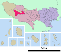 Location of Akiruno in Tokyo | ||
 Akiruno
| ||
| Coordinates: 35°43′44″N 139°17′39″E / 35.72889°N 139.29417°ECoordinates: 35°43′44″N 139°17′39″E / 35.72889°N 139.29417°E | ||
| Country | Japan | |
| Region | Kantō | |
| Prefecture | Tokyo | |
| Area | ||
| • Total | 73.34 km2 (28.32 sq mi) | |
| Population (July 1, 2014) | ||
| • Total | 81,919 | |
| • Density | 1,116.98/km2 (2,893.0/sq mi) | |
| Time zone | Japan Standard Time (UTC+9) | |
| - Tree | Osmanthus | |
| - Flower | Chrysanthemum | |
| - Bird | Japanese Wagtail | |
| Phone number | 042-558-1111 | |
| Address | 350 Ninomiya, Akiruno-shi, Tokyo 197-0814 | |
| Website |
www | |


Akiruno (あきる野市 Akiruno-shi) is a city in the western end of Tokyo, Japan. As of July 1, 2014, the city has an estimated population of 80,919 and a population density of 1,116.98 persons per km². The total area was 73.34 km².
Geography
Akiruno is located in the foothills of the Okutama Mountains of western Tokyo. The Akigawa River flows through the city.
Surrounding municipalities
- Fussa, Tokyo
- Hamura, Tokyo
- Ōme, Tokyo
- Hachioji, Tokyo
- Hinode, Tokyo
- Okutama, Tokyo
- Hinohara, Tokyo
History
The area of present day Akiruno was part of ancient Musashi Province. In the post-Meiji Restoration cadastral reform of July 22, 1878, the area became part of Nishitama District in Kanagawa Prefecture. The town of Itsukaichi was created on April 1, 1889 with the establishment of municipalities law. Nishitama District was transferred to the administrative control of Tokyo Metropolis on April 1, 1893. Itsukaichi expanded through annexation of neighboring villages in 1918 and 1955. Higashiakiru, Nishiakiru, and Tasai grouped together on April 1, 1955 to form the town of Akigawa, which was elevated to city status on May 5, 1971. The city of Akiruno was created on September 1, 1995 by the merger of the city of Akigawa with the neighboring town of Itsukaichi.
Transportation
Rail
- JR East – Itsukaichi Line
Highway
Sister city relations
 – Marlborough, Massachusetts, United States, since November 3, 1998
External links
| Wikimedia Commons has media related to Akiruno, Tokyo. |
- Official website (Japanese)
| ||||||||||||||||||||||||||