Akeld
| Akeld | |
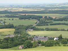 View over Akeld from the south |
|
 Akeld |
|
| Population | 82 (2001 census)[1] |
|---|---|
| OS grid reference | NT955295 |
| Unitary authority | Northumberland |
| Ceremonial county | Northumberland |
| Region | North East |
| Country | England |
| Sovereign state | United Kingdom |
| Post town | WOOLER |
| Postcode district | NE71 |
| Dialling code | 01668 |
| Police | Northumbria |
| Fire | Northumberland |
| Ambulance | North East |
| EU Parliament | North East England |
| UK Parliament | Berwick-upon-Tweed |
|
|
Coordinates: 55°33′32″N 2°04′23″W / 55.559°N 2.073°W
Akeld is a village and civil parish in Northumberland, England.[2] It is situated to the west of Wooler, and has a population of 82.[3] Its name is Anglo-Saxon Old English ac-helde, 'oak slope'.

Akeld Bastle
Akeld is dominated by the buildings of Akeld Manor and Country Club. To the south is Akeld Bastle, a sixteenth-century bastle house. Only the ground floor remains of the original building, the rest having been rebuilt in the eighteenth century.
History
From 1887 to 1930 the village was served by Akeld railway station.
Governance
Akeld is in the parliamentary constituency of Berwick-upon-Tweed.
References
External links
| Wikimedia Commons has media related to Akeld. |