Ajaokuta
| Ajaokuta igbedor ,anambra | |
|---|---|
|
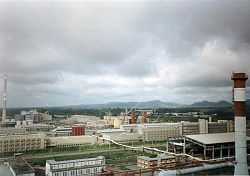
Ajaokuta Steel Rolling Mill, which manufactures iron materials | |
 | |
| Coordinates: 7°33′22″N 6°39′18″E / 7.55611°N 6.65500°E | |
| Country |
|
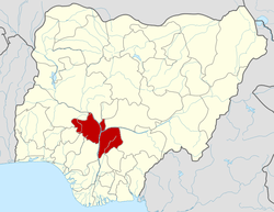
| State | Kogi State |
| Area | |
| • Total | 1,362 km2 (526 sq mi) |
| Population (2006 Census) | |
| • Total | 122,321 |
| Time zone | WAT (UTC+1) |
| 3-digit postal code prefix | 263 |
| ISO 3166 code | NG.KO.AJ |
Ajaokuta is a Local Government Area in Kogi State, Nigeria and a town within it on the left bank of the Niger River. The headquarters of the LGA are in the town of Egayin in the south of the area at 6°40′11″N 8°48′19″E / 6.66972°N 8.80528°E.
It has an area of 1,362 km² and a population of 122,321 at the 2006 census.
The postal code of the area is 263.[1]
As of 2008 Ajaokuta, the town, had an estimated population of 16,039.[2]
It is the home of the multi-billion dollar Ajaokuta Steel Rolling Mill.[3]
Transport
It is not as yet connected to the main railway system of Nigeria, except by river. An isolated standard gauge railway connects the steelworks to its source of iron ore at Itakpe. A connection of this railway to the port of Warri is unfinished.it connects the west of Nigeria to the east and also the north to the southern part, although it is not the only route to pass through but it helps.
See also
References
- ↑ "Post Offices- with map of LGA". NIPOST. Archived from the original on 7 October 2009. Retrieved 2009-10-20.
- ↑ "The World Gazetteer". Archived from the original on 2012-02-24. Retrieved 2007-04-03.
- ↑ Reviving Ajaokuta Steel Mill Archived April 13, 2014 at the Wayback Machine
External links
Coordinates: 07°33′22″N 06°39′18″E / 7.55611°N 6.65500°E
| |||||||||||||