Aitaroun
| Aitaroun عيترون | |
|---|---|
| City | |
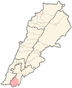
 Aitaroun Location within Lebanon | |
| Coordinates: 33°07′N 35°28′E / 33.117°N 35.467°ECoordinates: 33°07′N 35°28′E / 33.117°N 35.467°E | |
| Country |
|
| Governorate | Nabatieh Governorate |
| District | Bint Jbeil District |
| Time zone | EET (UTC+2) |
| • Summer (DST) | EEST (UTC+3) |
| Dialing code | +961 |
Aitaroun (or Aytaroun, Arabic: عيترون) is a Lebanese village located in the caza of Bint-Jbeil at 33.1156° North, 35.4722° East. It is on the northern border of Israel and 125 km from Beirut.
Population
Aitaroun is considered one of the larger villages in southern Lebanon with a total population estimated at 20,000 (2002). However, the actual number of residents is now considered to be significantly higher. The non-resident population is divided between emigrants and internal migrants distributed throughout Lebanon. Approximately 45% of the population is under the age of 30 and the average family size is 6-7 members.
Economy
Most families depend on agriculture as their primary source of income. During the 22 year Israeli occupation (1978 to 2000), the village received a significant cash flow from forced (as well as hired) enlistment in the Israeli funded South Lebanon Army and through work in Israel. Consequently self-harm and suicide was at a high rate during this period and especially amongst men who did not wish to take part.
Housing and infrastructure
It is estimated that there is more than 1300 homes in the village. An electrical network was established in 1964 and access to telecommunications is fully restored since 2006. In 2005 a telephone exchange was installed in the village offering connectivity to Lebanon's telephone network. Mobile communications and internet connectivity where also fully restored. During the occupation, potable water in the village was provided by water wells drilled in the village by Israel, but that supply was severed with the withdrawal in 2000. The main water source is the collection of rain water which is stored in both private and public reservoirs.
Government and social services
There are five schools operating in Aitaroun: two public and three private. Public schools, elementary and intermediate, encompass 250 students, with a higher percentage of girls especially for the intermediate level. The total number of students in the private schools amount to 570 distributed among one elementary school and two intermediate schools. The village has one health center operated by the Ministry of Social Affairs. The municipal council in the village was established in 1961.
2006 Israel-Lebanon conflict
At least 20 civilians from two families, including eight Canadians (Akhrass family), were killed when their Aitaroun homes were destroyed in Israeli airstrikes during the 2006 Israel-Lebanon conflict.
The village lost 41 villagers to the war new figures said. Families laid flowers and read Quranic verses at the graves on October 23, 2006, which marks the Eid ul-Fitr-holiday.[1]
History and Archaeology
Aitaroun contains a plethora of possible historic sites, many of which ransacked and their contents taken into Israel during the 22 year Israeli occupation. Untouched sites are still known to exist amongst locals within the greater village, though fear of greater looting and destruction of these sites has prevented their research.
Rumored archaeological finds in the village
An approximate 3m long, white-limestone sarcophagus with Christian carvings. It is described to have had lions heads, one on each side, and a carving of what is believed to be a knight with a sword. The sarcophagus would have weighed several tons and was removed by heavy equipment in 2000 and taken into Israel under the supervision of the SLA.
A foundation stone of a synagogue that once existed in the village and that is considered to be around 600 years old. Removed by the Israeli military in the early 90s.
Theories behind archaeological sites in the village
There are several theories behind the archaeological sites in Aitaroun.
One theory is that the village was a pilgrimage site for early Christians and for its water sources, some of which are believed to have been visited by Jesus. This is supported by other archaeological sites in surrounding villages.
Another theory is that the village was an ancient grave yard and an important trade route due to the water sources.
Another theory is that to hills surrounding the village had been military outposts for ancient armies. Strategically the village is surrounded by rocky hills with narrow valleys as entrances, and this would have made it an easy place to protect from the high ground. Evidence of such outposts also exist on the tops of the surrounding hills.
Another theory is that the village was part of a Roman olive (oil) and vineyard plantation outpost. The village would have also been mined for marble. There is evidence of vineyards and marble mines. The village being unlikely to have had an active vineyard for over 500 years. The variants of olives currently grown in the area also seem to be of Italian varieties grown for the purpose of olive oil.
There are well known historic locations of reservoirs, aqueducts or sources of water, much of which have dried up due to heavy agriculture activities across the border in Israel over the last several decades.
Flora
The area is rich in wild herbs, flowers and mushrooms. Particularly prevalent are the red poppy flower, wild capers and thistles.
Other flora that are believed to be more agricultural or introduced, include; grape vines, pomegranate trees, figs, cactus apple, sumac, various wild berries.
References
- ↑ "Violence casts shadow on normally festive Muslim holiday in Mideast". CBS. 23 October 2006.
External links
| |||||||||||||||||||||