Aiguille du Midi
| Aiguille du Midi | |
|---|---|
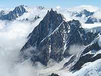
 The Aiguille du Midi in summer | |
| Elevation | 3,842 m (12,605 ft) |
| Prominence | 310 m (1,020 ft)[1] |
| Translation |
Needle of the Noon Needle of the South (French) |
| Location | |
 Aiguille du Midi France | |
| Location | Haute-Savoie, Rhône-Alpes, France |
| Range | Mont Blanc Massif |
| Coordinates | 45°52′43″N 06°53′14″E / 45.87861°N 6.88722°ECoordinates: 45°52′43″N 06°53′14″E / 45.87861°N 6.88722°E |
| Geology | |
| Type | Granite |
| Climbing | |
| First ascent | 4 August 1818 by Antoni Malczewski, J. M. Balmat and 5 guides |
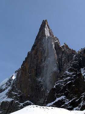
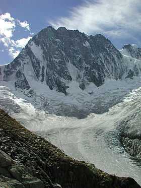
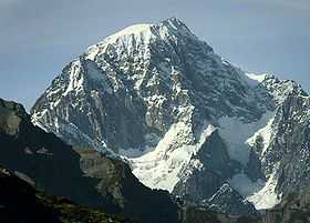
The Aiguille du Midi (3,842 m / 12,605 ft) is a mountain in the Mont Blanc massif in the French Alps.
Name
The name "Aiguille du Midi" translates literally as Needle of the South: i.e. -le Midi. The southern region of France is colloquially known as le Midi,[2][3] a defined geographical area consisting of the regions of France that border the Atlantic Ocean south of the Marais Poitevin,[4] Spain, the Mediterranean, and Italy.[5] [4]
Cable car
The cable car to the summit, the Téléphérique de l'Aiguille du Midi, was built in 1955 and held the title of the world's highest cable car for about two decades. It still holds the record as the highest vertical ascent cable car in the world, from 1,035 m to 3842 m. There are two sections: from Chamonix to Plan de l'Aiguille at 2,317 m and then directly, without any support pillar, to the upper station at 3,777 m (the building contains an elevator to the summit). The span of the second section is 2,867 m (1.781 mi) measured directly, but only 2,500 m (1.6 mi) measured horizontally. Thus it remains the second longest span width, measured directly. The tramway travels from Chamonix to the top of the Aiguille du Midi – an altitude gain of over 2,800 m – in 20 minutes. An adult ticket from Chamonix (as of 04/10/2014) is €55 return.
Summit
The Aiguille summit contains a panoramic viewing platform, a café and a gift shop. The Vallée Blanche ski run begins here, and the nearby Cosmiques Refuge is the starting point for one of the routes to the Mont Blanc summit. From the Aiguille another cable car (summer months only), the Vallee Blanche Aerial Tramway crosses the Glacier du Géant to Pointe Helbronner (3,462 m) at the Italian side of the Mont Blanc Massif. Pointe Helbronner is served with a cable car from La Palud, a village near Courmayeur in the Aosta Valley (Italy).
In December 2013, a glass skywalk called "Step into the Void" opened at the top of the Aiguille du Midi peak (3842 meters high). The view is 1035 meters straight down, and one can see Mont Blanc to the south.[6]
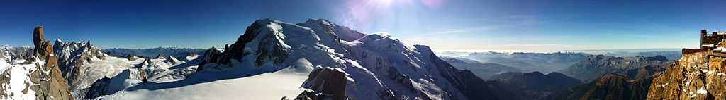
Photo gallery
-

The north face in winter
-

The lower platforms from the summit
-

Cable car terminus (1972)
-

Cable car terminus (2011)
-

Cable car going to Aiguille du Midi
-
-

Skywalk, December 27, 2013
References
- ↑ Swisstopo map
- ↑ Lyons, Declan (18 February 2009). Cycling guide to the Canal du Midi, Languedoc, France, Europe. Midpoint Trade Books. ISBN 978-1-85284-559-9.
- ↑ Passy, Paul (1904). International French-English and English-French dictionary. Hinds, Noble & Eldredge.
- ↑ 4.0 4.1 Louis Papy, Le midi atlantique, atlas et géographie de la France moderne, Flammarion, Paris, 1984
- ↑ "The Regions of France - Midi (from the Pyrenees to the Riviera)". about-france.com. Retrieved 2009-09-18.
- ↑ Will Coldwell,Step into the Void: the glass skywalk at the top of the French Alps – in pictures, The Guardian, 19 December 2013.
External links
| Wikimedia Commons has media related to Aiguille du Midi. |
- Website telepherique Aiguille du Midi
- Panoramic virtual tour from top of Aiguille du Midi
- (Photos) Photojournal from short stay at the top station of Téléphérique de l'Aiguille du Midi