Ahr Valley
| Ahr Valley | |
|---|---|
| Ahrtal | |
|
The Middle Ahr valley | |
 | |
| Geography | |
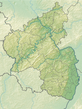
| Coordinates | 50°32′N 7°04′E / 50.533°N 7.067°ECoordinates: 50°32′N 7°04′E / 50.533°N 7.067°E |
| Watercourses | Ahr |

The Ahr valley (German: Ahrtal) is named after the Ahr, a left tributary of the River Rhine in Germany. It begins at the Ahr spring (Ahrquelle) in Blankenheim in the county of Euskirchen (North Rhine-Westphalia) and runs generally eastwards. At its southernmost point it enters the county of Ahrweiler, and hence the state of Rhineland-Palatinate. Running through the collective municipality of Adenau the valley bends northeast at its confluence with the Adenauer Bach and reaches the collective municipality of Altenahr, from where it resumes its characteristic west to east course, albeit interrupted by meanders. Here begins the section that is known as the Ahr valley (Ahrtal) in a touristic sense. Here it is characterized by vineyards on the south-facing slopes and a picturesque rocky landscape, carved out by the river creating a 300 metre deep gorge in the Ahr Hills. In the next stage the Ahr reaches the area of the county town of Bad Neuenahr-Ahrweiler, before finally discharging into the Rhine south of Remagen in the borough of Sinzig.


Course
Upper Ahr valley
From its head, the Ahr valley runs through a rolling uplands with pastures, woods and occasional hamlets or farmsteads. It is followed by the B 258 federal highway. The first noteworthy villages are Ahrhütte and Ahrdorf, in the municipality of Blankenheim. The Ahr valley then becomes gradually narrower and reaches its southernmost point where it leaves the state of Northe Rhine-Westphalia. The first village in Rhineland-Palatinate that it encounters is Dorsel, on the heights above the valley. In Müsch the B 258 leaves the Ahr valley, and the L 73 then accompanies the river, which is still small at this stage. From here the valley runs through Antweiler to Fuchshofen, almost northwards, before swinging almost due east from Schuld, passing Insul and reaching Dümpelfeld where it is joined by the B 257. Here, at its confluence with the Adenauer Bach, coming from the south, the Ahr heads northeast, leaves the collective municipality (VG) of Adenau and reaches the collective municipality village of Altenahr south of Liers, which belongs to Hönningen gehörenden. This is now the middle course of the Ahr, the Mittelahr.
Middle Ahr valley
The valley runs initially northeastwards from Hönningen via Ahrbrück, Pützfeld, Kreuzberg and Altenburg to Altenahr. From Ahrbrück the B 257 is joined by the Ahr Valley Railway which follows the valley to the Rhine. At Altenahr the valley bends east and initially has an extremely meandering course. Here, the river is accompanied by the B 267, although it does not follow every bend. In Altenahr is the start of the great Ahr loop (Ahrschleife) which is protected dued to its flora and fauna. From here the valley is ravine-like, its rugged rock faces cutting into the Ahr Hills. From Reimerzhoven there are extensive vineyards especaill on the northern side of the river (i.e. on the south-facing slopes). Near Laach the Ahr runs round another loop in the valley and then passes the wine villages of Mayschoß, Rech, Dernau and Marienthal before finally reaching the territory of the town of Bad Neuenahr-Ahrweiler. The last narrow portion of the Ahr valley lies below the Bunte Kuh ("Coloured Cow"), a rock formation that reaches almost to the river and leaves hardly any room for road and railway. In Walporzheim the valley bottom broadens suddenly into the Lower Ahr Valley (untere Ahrtal).
Lower Ahr valley
The lower Ahr valley is also dominated by vineyards. The Ahr flows through the settlements of Ahrweiler, Bad Neuenahr, Heppingen and Heimersheim, where the vineyards end. The valley floor between Bad Bodendorf on the northern edge and Sinzig on a terrace to the south, is characterised by arable farming, fruit and vegetable growing. The confluence of the Ahr with the Golden Mile of the Rhine near Kripp has an almost natural character and is a nature reserve.
Transport and infrastructure
The Ahr Valley Railway runs from Remagen initially double-tracked, before reducing to a single track from Walporzheim, to Ahrbrück. The line is closed beyond that point.
Literature
- Vera Kettenbach: Das Ahrtal von Bad Bodendorf bis Altenahr. Gaasterland-Verlag, 3. Aufl., Düsseldorf, 2010, ISBN 978-3-935873-02-4
- Heinz Schönewald: Bad Neuenahr. Gaasterland-Verlag, Düsseldorf, 2006, ISBN 3-935873-13-1
- Hans-Georg Klein: Ahrweiler. Gaasterland-Verlag, Düsseldorf, 2005, ISBN 3-935873-05-0
- AhrtalReise. Gaasterland-Verlag, Düsseldorf, 2007, ISBN 978-3-935873-18-5
- Christoph Bach: Der Regierungsbunker im Ahrtal und seine Geschichte. Gaasterland-Verlag, Düsseldorf 2008, ISBN 978-3-935873-30-7.
- Das Ahrthal, malerische Ansichten / nach Originalzeichnungen in Stahl gest. von den vorzüglichsten Künstlern. Bonn : Habicht, [ca. 1840], Online-Ausgabe dilibri Rheinland-Pfalz
- Neuestes Album vom schönen Ahrthal. Bonn : Foppen, [ca. 1870], Online-Ausgabe dilibri Rheinland-Pfalz
- Heinz Schönewald: Bad Neuenahr - Das Weltbad der Kaiserzeit. Sutton Verlag, Erfurt 2009, ISBN 978-3-86680-465-4
External links
| Wikivoyage has a travel guide for Ahrtal. |
- Literatur über das Ahr Valley in the German National Library catalogue
- Ahrtal-Tourismus Bad Neuenahr-Ahrweiler e.V.
- Ahrtal, Ahrwein, Weingüter und Weinfeste
- Kreisverwaltung Ahrweiler
- Ahrtalweg
- Die Mittelahr
- Hochwasser an der Ahr
|