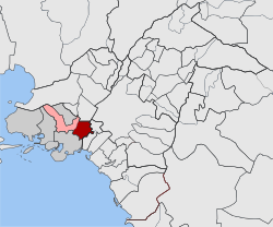
Agios Ioannis Rentis
| Agios Ioannis Rentis Άγιος Ιωάννης Ρέντης | |
|---|---|
 Agios Ioannis Rentis | |
|
Location within the regional unit  | |
| Coordinates: 37°58′N 23°40′E / 37.967°N 23.667°ECoordinates: 37°58′N 23°40′E / 37.967°N 23.667°E | |
| Country | Greece |
| Administrative region | Attica |
| Regional unit | Piraeus |
| Municipality | Nikaia-Agios Ioannis Rentis |
| • Municipal unit | 4.524 km2 (1.747 sq mi) |
| Elevation | 10 m (30 ft) |
| Population (2011)[1] | |
| • Municipal unit | 16,050 |
| • Municipal unit density | 3,500/km2 (9,200/sq mi) |
| Time zone | EET (UTC+2) |
| • Summer (DST) | EEST (UTC+3) |
| Postal code | 182 xx |
| Area code(s) | 210 |
| Website | www.cityofrentis.gr |
Agios Ioannis Rentis (Greek: Άγιος Ιωάννης Ρέντης) is a suburb and a former municipality in the western part of the Athens-Piraeus agglomeration, Greece. Since the 2011 local government reform it is part of the municipality Nikaia-Agios Ioannis Rentis, of which it is a municipal unit.[2]
Geography
Agios Ioannis Rentis is an industrialized suburb, located about 5 km (3 mi) west of central Athens and 3 km (2 mi) northeast of Piraeus. The small river Cephissus runs through it. Two important transport axes pass through the municipality: Motorway 1 (Athens- Thessaloniki) and the Piraeus–Platy railway, on which it has a passenger station (Rentis) and a large marshalling yard. The Olympiakos FC training center is in this area.
Historical population
| Year | Municipality population |
|---|---|
| 1981 | 16,276 |
| 1991 | 14,218 |
| 2001 | 15,060 |
| 2011 | 16,050 |
International relations
Agios Ioannis Rentis is twinned with Kadıköy, Turkey, since 2003.[3]
See also
- List of municipalities of Attica
References
- ↑ "Detailed census results 2011" (in Greek).
- ↑ Kallikratis law Greece Ministry of Interior (Greek)
- ↑ "Twinnings". Central Union of Municipalities & Communities of Greece. Retrieved 2013-08-25.
External links
- Official website (Greek)
 |
Nikaia | Aigaleo |  | |
| |
Tavros | |||
| ||||
| | ||||
| Piraeus | Moschato |
| ||||||