Aghavoher
| Aghavoher | |
|---|---|
| Irish transcription(s) | |
| • Derivation: | Achadh an Mhothair |
| • Meaning: | "field of the trees or mound" |
| Country | Ireland |
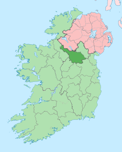
| County | County Cavan |
| Barony | Loughtee Lower |
| Civil parish | Tomregan |
| Area | |
| • Total | 92 ha (228 acres) |
Aghavoher (from Irish: Achadh an Mhothair, meaning "field of the trees or mound") is a townland in the civil parish of Tomregan, County Cavan, Ireland. It lies in the former barony of Loughtee Lower.[1]
Geography
Aghavoher is bounded on the north by Cranaghan townland, on the west by Clifton, Mullynagolman and Carrigan townlands, on the south by Breandrum townland and on the east by Greaghrahan and Carn townlands. Its chief geographical features are Aghavoher Lough and the Rag River on its northern boundary and a small hill which rises to 306 feet above sea level. Aghavoher is traversed by the Kildallan road and Carrigan lane.
The townland covers 228 statute acres,[2] including eleven acres of water.
History
The earliest surviving spelling of the townland name is in a printed list of Cavan townlands dated 1790 where it is spelled "Aughiogher". Centuries before that the townland formed part of the Black Pig's Dyke in pre-Christian times.
Aghavoher formed part of the termon lands belonging to Tomregan Roman Catholic Church which were granted to the Church of Ireland Bishop of Kilmore in 1610 as part of the Plantation of Ulster. By a lease dated 6 April 1612 the said bishop granted the lands to Sir Oliver Lambart of Kilbeggan, County Westmeath and Sir Garrett Moore of Mellifont, County Louth. On 17 July 1639 the bishop re-granted the lands to Charles Lambart, 1st Earl of Cavan.
Griffith's Valuation of 1857 lists the landlords of the townland as Jones and Moore and the tenants as Berry, Winslow and Kellett.[3]
In the 1911 census of Ireland, there are five families listed in the townland.[4]
The chief structures of historical interest in the townland are a Bronze-Age ring-barrow on the border with Clifton;[5] a medieval crannóg in Aghavoher Lough;[6] and Sandville House and Sandybrook House.
References
- ↑ "Placenames Database of Ireland". Retrieved 29 February 2012.
- ↑ "IreAtlas". Retrieved 29 February 2012.
- ↑ Griffith’s Valuation 1857 - Aghavoher
- ↑ Census of Ireland 1911 - Aghavoher
- ↑ Site number 94, page 20, Aghavoher townland, in “Archaeological Inventory of County Cavan”, Patrick O’Donovan, 1995
- ↑ Site number 1467, page 175, Aghavoher townland, in “Archaeological Inventory of County Cavan”, Patrick O’Donovan, 1995
External links
| ||||||||||||||||||||||||||||||