Aghavannagh

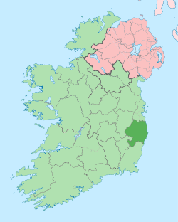
Aghavannagh (Irish: Achadh Bheannach, meaning "Hilly field") is a small village and townland in south County Wicklow, Republic of Ireland in the barony of Ballinacor South. It is located on the Military Road originally constructed between 1804 and 1809, in the wake of the 1798 rebellion. It is so remote that inhabitants say that Aghavannagh is the last place God made.[1]
Location
The village is situated near the base of the Lugnaquilla massif, the highest mountain in eastern Ireland, and within a few miles of Aughrim, Glenmalure and Tinahely to the east and south, and Kiltegan, Hacketstown and Baltinglass to the west. The area is mainly surrounded by forests and is composed of mountains and mountain land. This fact may indicate an original name in Irish as achadh mbeannach whose meaning is hilly field.[2] This mountainous terrain is where the Ow river rises on the southern slopes of Lugnaquilla, flows through a glacial valley and passes the outskirts of the village meeting the Aghavannagh river, which is much smaller and flows through the village, a short distance to the south.[3]
One of the earliest references to the place is in 1623 to "Aghavanny" in the Calendar of Patent Rolls of James I, followed by five other 17th century references with three different spellings of "Aghamanagh", "Aghamannagh" "Aghavannagh", and lastly "Aghavanagh" on A.R. Neville's Map of Co. Wicklow dated c 1810.[2]
There is no commercial centre to the village that only comprises residences and a school (on map— no longer in use). Between 1896 and 1899 a sub-post office was opened in Aghavannagh under the nearby post town of Aughrim but this was already closed by 1909.[4]
Military barracks
Aghavannagh Barrack, along with similar structures in Glencree, Laragh and Glenmalure,[5] was one of a series of barracks built along the route of the military road, to house British forces and give them access to the Wicklow Mountains where many 1798 rebels, such as Michael Dwyer,[6] sought refuge. The property came into the ownership of Charles Stewart Parnell's grandfather after the British War Office vacated it in 1825 because he was the ground landlord and was used by him as a hunting lodge. The Parnell family shared the building with up to 50 men of the Irish Constabulary. Several of the outhouses were totally ruined at this time.[7] Upon Parnell's death, John Redmond bought the barracks.[8]
Later, An Óige ran the building as a youth hostel for several years before acquiring ownership in 1944. They closed it in 1998 when a tower of the structure was declared unstable by engineers.[9] Síle de Valera, then Minister for Arts, Heritage, Gaeltacht and the Islands, answered a question in the Dáil whether the property would be acquired by the government as a heritage building saying that Dúchas, the heritage service of the department, did not have the resources to protect or preserve the building.[10]
References and sources
- ↑ Nolan, Winefride (1952). The New Invasion. Macmillan.
- ↑ 2.0 2.1 Price, Liam (1946). The Place-Names of Co. Wicklow: II—The Barony of Ballinacor South. Dublin: Dublin Institute for Advanced Studies. pp. 55–56.
- ↑ Ordnance Survey Map of The Wicklow Way. Dublin: Ordnance Survey of Ireland. 1981. p. 1.
- ↑ Frank, Harald; Stange, Klaus (29 September 1990). Irish Post Offices and their postmarks 1600–1990. Munich: Forchumgs- und Arbeitsgemeinschaft Irland e.V. p. 294.
- ↑ Dillon, Paddy (2005). Irish Coast to Coast Walk (2nd ed.). Milnthorpe, Cumbria, UK: Cicerone Press Limited. p. 58. ISBN 1-85284-433-7.
- ↑ Power, Pat (2004). "The County Wicklow Military Road (Part 5): Barracks on the Road". Journal Vol. 4 (Greystones Archaeological & Historical Society). Retrieved 3 December 2011.
- ↑ Power, Pat (2004). "The County Wicklow Military Road (Part 8): Aughavannagh Barrack". Journal Vol. 4 (Greystones Archaeological & Historical Society). Retrieved 3 December 2011.
- ↑ Gwynn, Stephen (1934). The Charm of Ireland. Harrap. p. 89.
- ↑ O'Doherty, Caroline (23 October 1998). "Business figures asked for help in saving historic youth hostel". Business News (The Examiner). Retrieved 4 April 2008.
- ↑ "Dáil Éireann – Volume 495 – 20 October 1998 Written Answers – Youth Hostels". Parliamentary Debates. Office of the Houses of the Oireachtas. 20 October 1998. Retrieved 4 April 2008.
See also
External links
- The County Wicklow Military Road Greystones Archaeological & Historical Society: Journal: Volume 4, 2004.
| ||||||||||||||||||||||