Agharaskilly
| Agharaskilly | |
|---|---|
| transcription(s) | |
| • Derivation: | Uncertain |
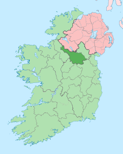
| Country | Ireland |
| County | County Cavan |
| Barony | Loughtee Lower |
| Civil parish | Tomregan |
| Area | |
| • Total | 220 ha (550 acres) |
Agharaskilly (origin uncertain) is a townland in the civil parish of Tomregan, County Cavan, Ireland. It lies within the former barony of Loughtee Lower.[1]
Etymology
The derivation of townland name is uncertain. It has been suggested that it may come from an anglicisation of the Irish placename Achadh chroise coille meaning "field of the cross of the wood"[1] or Achadh Ros Choille which means "Field of the Grove of Trees". Alternative meanings which have been suggested are "Cattlefield of the Cross of the Church", "Field of the Boar's Wood" and "Field of the Crossroads in the Wood".
The earliest surviving mention of the townland is in a grant dated 10 August 1607 from King James I to Sir Garrett Moore of Mellifont where it is spelled Aghcrossekille. On the 1609 Plantation of Ulster map of the barony of Loughtee, it is spelt Reskellew. A 1627 grant spells it as Aghocrossekeillie. The 1641 Rebellion Depositions spell it variously as Aghroskilly, Agheraskilly and Aighroskillow. The will of Terence Donocky dated 1735 spells it as Augharaskillane.
Geography
A sub-division of the townland is Derryliffe which is an anglicisation of the Gaelic placename Doire Life which means "The Oak-Wood of Liffey".
Agharaskilly is bounded on the north by Cullyleenan townland, on the east by Mullaghduff & Cavanagh townlands, on the south by Cloncollow, Slievebrickan, Fartrin & Killarah townlands and on the west by Cormeen and Lecharrownahone townlands.
Its chief geographical features are the Shannon-Erne Waterway, which flows north along the western boundary of the townland, and several small drumlin hills reaching to 200 feet (61 m) above sea-level.[2] Agharaskilly is traversed by the Killeshandra road and some minor lanes. The townland covers 550 acres (2.2 km2),[3] including 8 acres (32,000 m2) of water.[2]
History
In the aforementioned grant dated 10 August 1607 from King James I to Sir Garrett Moore of Mellifont, the townland was described as "the farm, termon or hospital of Aghcrossekille containing 2 polls at an annual rent of 6 ½ shillings". The two polls now form the two modern townlands of Agharaskilly and Fartrin.
On the death of Thomas Moigne, the Church of Ireland Bishop of Kilmore, on 1 January 1629, Sir Edward Bagshaw of Finglas—County Dublin owner of the Manor of Castle Bagshawe, Belturbet—took adverse possession of Agharaskilly. William Bedell, who succeeded Moigne as Bishop of Kilmore disputed this act of Bagshaw’s. Bedell petitioned Lord Viscount Falkland, the Lord Deputy of Ireland in August 1629 as follows:
- "Sir Edward Bagshaw, Knight, since the death of the late bishop, in the vacancy of the said sees hath entered upon two poles of land called Agarosikilly, parcel of the Termon of the see of Kilmore, whereof your petitioner's predecessor died seised. Your Petitioner humbly prayeth that he may be restored to the possession of the said lands enjoyed by his predecessor, and kept in the same, till the said Sir Edward Bagshaw shall show reason to the contrary to this Board."[4]
On 28 May 1654 Sir Edward Bagshaw gave the townland to his daughter Anne as part of her dowry on her marriage to Thomas Richardson of Dublin, son of the Bishop of Ardagh (John Richardson (d. 1654)). By a deed dated 30 April 1661 Thomas Richardson granted "Aghacrossikilley alias Aghacrussacully" to Captain Thomas Gwyllym, the landlord of Ballyconnell and has been part of the Ballyconnell estate since.[5]
The 1641 Rebellion Depositions give the names of Irish rebels living in Agharaskilly as: Conor Realy of Aighroskillow in the parish of kildallen gentleman, Torlough Manahan Rely of same gentleman, Edmond Rely of same gentleman, Owen Rely of same gentleman, Hugh Rely of same gentleman, Cahyre Rely of same gentleman, Phillip Rely of same gentleman, Bryan Rely of same gentleman.[6]
Griffith's Valuation of 1857 lists the landlords of the townland as representatives of William Enery: Seaton, McAdam, Donohoe, Cox and Jones and the tenants as Benson: Enery, Kiernan, Reilly, Fitzpatrick, McAdam, Donohoe, Cox, Hunt, Flanagan, Maguire, Kane, Reilly, Gregory, Latimer and Jones.[7]
In the 1911 census of Ireland, there are nineteen families listed in the townland.[8]
The only historic site in the townland is a medieval ringfort situate in the south-east corner near the boundary with Cavanagh.[9]
References
- ↑ 1.0 1.1 "Placenames Database of Ireland". Retrieved 29 February 2012.
- ↑ 2.0 2.1 Ordnance Survey of Ireland maps
- ↑ "IreAtlas". Retrieved 29 February 2012.
- ↑ "Memoir of the Life of Bishop Bedell" by Alexander Clogy, page 40
- ↑ "The Plantation in Ulster" by George Hill
- ↑ Trinity College Dublin - 1641 Depositions
- ↑ Griffith’s Valuation 1857 - Agharaskilly
- ↑ Census of Ireland 1911 - Agharaskilly
- ↑ Site number 201, Agharaskilly townland, page 39 in “Archaeological Inventory of County Cavan”, Patrick O’Donovan, 1995.
External links
| ||||||||||||||||||||||||||||||