Aetomilitsa
| Aetomilitsa Αετομηλίτσα | |
|---|---|
|
View on Aetomilitsa village, Ioannina prefecture, Greece. Peaks of Grammos mountain visible in the background | |
 Aetomilitsa | |
|
Location within the regional unit 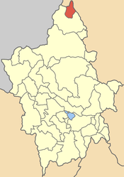 | |
| Coordinates: 40°18.6′N 20°51.3′E / 40.3100°N 20.8550°ECoordinates: 40°18.6′N 20°51.3′E / 40.3100°N 20.8550°E | |
| Country | Greece |
| Administrative region | Epirus |
| Regional unit | Ioannina |
| Municipality | Konitsa |
| Highest elevation | 1,485 m (4,872 ft) |
| Lowest elevation | 1,385 m (4,544 ft) |
| Population (2011)[1] | |
| • Municipal unit | 432 |
| Time zone | EET (UTC+2) |
| • Summer (DST) | EEST (UTC+3) |
| Postal code | 440 15 |
| Area code(s) | +30-2655-xxx-xxx |
| Vehicle registration | INx-xxxx |

Aetomilitsa (Greek: Αετομηλίτσα, Aromanian: Densko, Denicko) is a village Konitsa municipality. Since the 2011 local government reform it was an independent community.[2][3] The 2011 census recorded 432 residents in the village.[1] The community of Aetomilitsa covers an area of 51.297 km2.[3] In the past it was known as Denisko or Densko (Ντένισκο).[4]
Geography
It lies on the Gramos mountain. It is one of the highest communities in Greece situated at an altitude between 1385 and 1485m.
History
During the Greek Civil War Aetomilitsa was considered the seat of the leftist rebels, the so-called "Democratic Army of Greece", because there its leader Markos Vafiadis formed the "government of the mountain".[4]
References
- ↑ 1.0 1.1 "Detailed census results 2011" (in Greek).
- ↑ Kallikratis law Greece Ministry of Interior (Greek)
- ↑ 3.0 3.1 Πίνακας 3. Πραγματικός πληθυσμός, επιφάνεια και πυκνότητα του πληθυσμού, με διάκριση σε αστικές και αγροτικές περιοχές καθώς και σε πεδινές, ημιορεινές και ορεινές περιοχές. Μέσος σταθμικός των υψομέτρων. (PDF) (in Greek). Ελληνική Στατιστική Αρχή (Hellenic Statistical Authority). Retrieved 11 December 2013.
- ↑ 4.0 4.1 http://www.mlahanas.de/Greece/Cities/Aetomilitsa.html
| ||||||||||||||||||||||