Administrative divisions of South Africa
The primary administrative divisions of South Africa are the nine provinces. The provinces are divided into metropolitan and district municipalities, with the district municipalities being further divided into local municipalities. Metropolitan and local municipalities are divided into wards.
Provinces

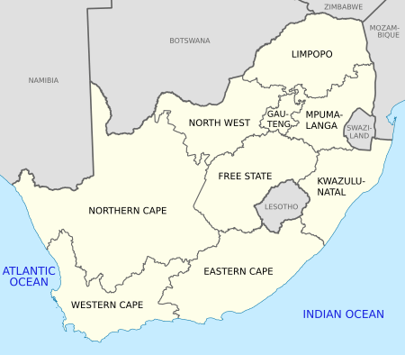
Since 1994, South Africa has been divided into nine provinces: the Eastern Cape, the Free State, Gauteng, KwaZulu-Natal, Limpopo, Mpumalanga, North West, the Northern Cape and the Western Cape. The boundaries of the provinces, which are specified in the national constitution, have been altered twice by constitutional amendment.
Each province is governed by a unicameral legislature elected by party-list proportional representation, and a Premier elected by the legislature. The provincial legislatures are represented in the national Parliament by their delegations to the National Council of Provinces.[1]
Metropolitan municipalities
.svg.png)
Eight of South Africa's largest cities are governed as metropolitan municipalities, which exercise all municipal functions in their areas, in contrast with the divided responsibilities in areas with the district/local system (see below).[2] Metropolitan municipalities are governed by councils in which half of the councillors are directly elected from the wards (see below) and half are elected by party-list proportional representation.[3]
The eight metropolitan municipalities are: Buffalo City (East London), City of Cape Town (Cape Town), Ekurhuleni (East Rand), eThekwini (Durban), City of Johannesburg (Johannesburg), Mangaung (Bloemfontein), Nelson Mandela Bay (Port Elizabeth), and City of Tshwane (Pretoria).[2][4]
District municipalities
.svg.png)
Outside the metropolitan municipalities, the rest of South Africa is divided into 44 district municipalities. These cover large regions of the provinces, and are in turn divided into local municipalities (see below).[2] The district municipalities are responsible for "district-wide" municipal functions, including development planning, bulk supply of utilities, arterial roads, and public transport. In district councils, 60% of the councillors are nominated by the councils of the constituent local municipalities, while the remaining 40% are elected by the population by party-list proportional representation.[3]
Local municipalities
.svg.png)
The district municipalities are divided into a total of 226 local municipalities. In general, a local municipality includes one or more towns and the surrounding villages and rural areas. A local municipality exercises all the municipal functions not carried out by the district municipality within which it lies. Local municipalities' councils are elected in the same way as those of metropolitan municipalities: half from wards and half by proportional representation.[3]
Wards

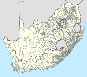
Metropolitan and local municipalities are divided into wards, with each ward electing one councillor to the municipal council. As of May 2011 there are 4,277 wards in South Africa.[5]
References
- ↑ "Provincial government". SouthAfrica.info. Brand South Africa. Retrieved 22 April 2011.
- ↑ 2.0 2.1 2.2 "Local government". South Africa.info. Brand South Africa. Retrieved 22 April 2011.
- ↑ 3.0 3.1 3.2 "Elections in South Africa". Community Organisers Toolbox. Education and Training Unit (ETU). Retrieved 22 April 2011.
- ↑ Gabara, Nthambeleni (9 December 2011). "Buffalo City, Mangaung categorised Metros". BuaNews (Government Communication and Information System). Retrieved 22 April 2011.
- ↑ Gabara, Nthambeleni (1 September 2010). "More wards ahead of local govt elections". BuaNews (Government Communication and Information System). Retrieved 22 April 2011.
| ||||||||||||||||||||||||||||||
| ||||||||||||||