Adelaida, California
| Adelaida, California | |
|---|---|
| Unincorporated community | |
 Adelaida, California | |
| Coordinates: 35°38′44″N 120°52′25″W / 35.64556°N 120.87361°WCoordinates: 35°38′44″N 120°52′25″W / 35.64556°N 120.87361°W | |
| Country | United States |
| State | California |
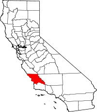
| County | San Luis Obispo |
| Elevation | 1,404 ft (428 m) |
| Time zone | Pacific (PST) (UTC-8) |
| • Summer (DST) | PDT (UTC-7) |
| Area code(s) | 805 |
| GNIS feature ID | 1660231[1] |
Adelaida is an unincorporated community in San Luis Obispo County, California, United States. Adelaida is 10 miles (16 km) west of Paso Robles. The community had a post office from 1877 to 1936.[2]
History
In the 1880s, the population of Adelaida was approximately 500, supported by the prospering Klau and Buena Vista mercury mines. The town boasted a community center, saloon, dance hall, general store, and four schools. The population increased further in 1898 with an influx of Mennonite settlers. The Adelaida School, located near the entrance to the Osgood Ranch on Chimney Rock Road, was built in 1917. It is still standing, although has been vacant since 1964. This school and the Klau Mine Road cemetery are all that is left of old Adelaida. Although the quicksilver mines were in operation into the 1970s, most of the local businesses had long since relocated to Paso Robles.[3]
See also
References
- ↑ "US Board on Geographic Names". United States Geological Survey. 2007-10-25. Retrieved 2008-01-31.
- ↑ Durham, David L. (1998). California's Geographic Names: A Gazetteer of Historic and Modern Names of the State. Quill Driver Books. p. 861. ISBN 1-884995-14-4.
- ↑ David W. Kean, Wide Places in the California Roads: The encyclopedia of California's small towns and the roads that lead to them (Volume 1 of 4: Southern California Counties), pp. 11-12
| |||||||||||||||||||||||||