Adams Township, Darke County, Ohio
| Adams Township, Darke County, Ohio | |
|---|---|
| Township | |
|
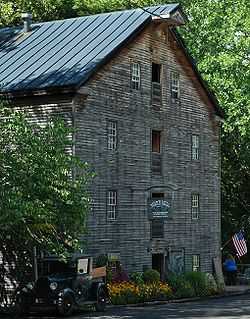
Bear's Mill, a historic site in the township | |
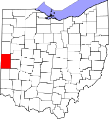
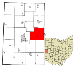 Location in Darke County and the state of Ohio. | |
| Coordinates: 40°7′47″N 84°29′17″W / 40.12972°N 84.48806°WCoordinates: 40°7′47″N 84°29′17″W / 40.12972°N 84.48806°W | |
| Country | United States |
| State | Ohio |
| County | Darke |
| Area | |
| • Total | 37.6 sq mi (97.4 km2) |
| • Land | 37.5 sq mi (97.1 km2) |
| • Water | 0.1 sq mi (0.3 km2) |
| Elevation[1] | 1,004 ft (306 m) |
| Population (2000) | |
| • Total | 3,508 |
| • Density | 93.5/sq mi (36.1/km2) |
| Time zone | Eastern (EST) (UTC-5) |
| • Summer (DST) | EDT (UTC-4) |
| FIPS code | 39-00254[2] |
| GNIS feature ID | 1086009[1] |
Adams Township is one of the twenty townships of Darke County, Ohio, United States. The 2000 census found 3,508 people in the township, 2,125 of whom lived in the unincorporated portions of the township.[3]
Geography
Located in the eastern part of the county, it borders the following townships:
- Wayne Township - north
- Newberry Township, Miami County - east
- Newton Township, Miami County - southeast corner
- Franklin Township - south
- Van Buren Township - southwest
- Greenville Township - west
- Richland Township - northwest
Two incorporated villages are located in Adams Township: part of Bradford in the east, and Gettysburg in the south.
Name and history
It is one of ten Adams Townships statewide.[4]
Adams Township was established in 1819.[5]
A historic site in Adams Township is Bear's Mill. Located along Greenville Creek in southwestern Adams Township,[6] it is a working gristmill that was built in the 1840s.[7]
Government
The township is governed by a three-member board of trustees, who are elected in November of odd-numbered years to a four-year term beginning on the following January 1. Two are elected in the year after the presidential election and one is elected in the year before it. There is also an elected township fiscal officer,[8] who serves a four-year term beginning on April 1 of the year after the election, which is held in November of the year before the presidential election. Vacancies in the fiscal officership or on the board of trustees are filled by the remaining trustees. The current trustees are David Brewer, Claude Fenstermaker, and Donald Lecklider, and the clerk is E. Scott Crist.[9]
References
- ↑ 1.0 1.1 "US Board on Geographic Names". United States Geological Survey. 2007-10-25. Retrieved 2008-01-31.
- ↑ "American FactFinder". United States Census Bureau. Retrieved 2008-01-31.
- ↑ Darke County, Ohio — Population by Places Estimates Ohio State University, 2007. Accessed 15 May 2007.
- ↑ "Detailed map of Ohio" (PDF). United States Census Bureau. 2000. Archived (PDF) from the original on 16 March 2007. Retrieved 2007-02-16.
- ↑ The History of Darke County, Ohio. W. H. Beers & Company. 1880. p. 416.
- ↑ DeLorme. Ohio Atlas & Gazetteer. 7th ed. Yarmouth: DeLorme, 2004, 54. ISBN 0-89933-281-1.
- ↑ Owen, Lorrie K., ed. Dictionary of Ohio Historic Places. Vol. 1. St. Clair Shores: Somerset, 1999, 301.
- ↑ §503.24, §505.01, and §507.01 of the Ohio Revised Code. Accessed 4/30/2009.
- ↑ Township Trustees, Darke County, 2010-03-17. Accessed 2010-07-29.
External links
| |||||||||||||||||||||||||||||