Achandunie
| Achandunie | |
| Scottish Gaelic: Achadh an Dùnaidh | |
 Near Achandunie |
|
 Achandunie |
|
| OS grid reference | NH591671 |
|---|---|
| Council area | Highland |
| Country | Scotland |
| Sovereign state | United Kingdom |
| Postcode district | IV |
| Police | Scottish |
| Fire | Scottish |
| Ambulance | Scottish |
| EU Parliament | Scotland |
| UK Parliament | Caithness, Sutherland and Easter Ross |
| Scottish Parliament | Caithness, Sutherland and Ross |
Coordinates: 57°43′06″N 4°16′38″W / 57.7184°N 4.2772°W
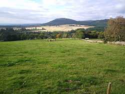
Achandunie (Scottish Gaelic: Achadh an Dùnaidh) is a village north of Alness in Ross-shire in the Scottish council area of the Highland. The village lies on the B9176 road to the north of Alness.[1]
References
- ↑ Google Maps (Map). Google.