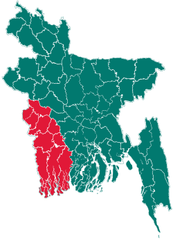
Abhaynagar Upazila
| Abhaynagar অভয়নগর | |
|---|---|
| Upazila | |
 Abhaynagar Location in Bangladesh | |
| Coordinates: 23°1′N 89°26′E / 23.017°N 89.433°ECoordinates: 23°1′N 89°26′E / 23.017°N 89.433°E | |
| Country |
|
| Division | Khulna Division |
| District | Jessore District |
| Area | |
| • Total | 247.21 km2 (95.45 sq mi) |
| Population (2011 Census) | |
| • Total | 262,434 |
| • Density | 1,100/km2 (2,700/sq mi) |
| Time zone | BST (UTC+6) |
| Website | Official Map of Abhaynagar |
Abhaynagar (Bengali: অভয়নগর) is an upazila of Jessore District in the Division of Khulna, Bangladesh.
Demographics
According to the 2011 Bangladesh census, Abhaynagar's population was 262,434. In 1991 males constituted 52.06% of the population, females 47.94%. The population aged 18 or over was 110,761. Abhaynagar had an average literacy rate of 38.8% (7+ years), compared to a national average of 32.4%.[1]
Economy
The principal agricultural products are rice, wheat, jute, potatoes, garlic, onions, mustard, betel nuts, brinjal and vegetables. The principal industrial products are jute, textiles, leather, salt and cement.
Special features
Among the archeological interests in Abhaynagar are Siddhipasha Rajbari with its adjacent tank and temple, 11 Duari Mandir, Madhayapur Neelkuthi and Sreedharpur Zamindar Bari. Three periodicals are published: the weekly Mukti and Uddipan, and the monthly Mukul.
History
On 4 December 2005 over 300,000 people of Abhaynagar took to the roads and blocked the Jessore-Khulna Highway in the Nowapaara industrial area to protest against a longstanding waterlogging problem. The protest took place after 25,000 people took part in a silt removal drive in the Sri River at Vobodoho sluice gate on November 9. Over 100 people were injured in violent clashes during the protest.[2]
See also
References
- ↑ "Population Census Wing, BBS.". Archived from the original on March 27, 2005. Retrieved November 10, 2006.
- ↑ "Hundreds of people block Jessore-Khulna Highway". Correspondent (New Age). 2005-12-04. Retrieved 2006-02-18.
External links
- Md. Saifur Rahman (2006). "Abhaynagar Upazila". In Sirajul Islam. Banglapedia: National Encyclopedia of Bangladesh. Asiatic Society of Bangladesh.
- BBS: Abhaynagar Upazila
| ||||||||
