Abbyville, Kansas
| Abbyville, Kansas | |
|---|---|
| City | |
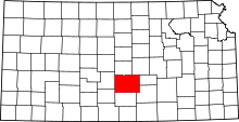
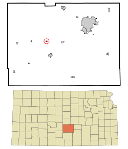 Location within Reno County (top) and Kansas (bottom) | |
| Coordinates: 37°58′14″N 98°12′14″W / 37.97056°N 98.20389°WCoordinates: 37°58′14″N 98°12′14″W / 37.97056°N 98.20389°W | |
| Country | United States |
| State | Kansas |
| County | Reno |
| Area[1] | |
| • Total | 0.19 sq mi (0.49 km2) |
| • Land | 0.19 sq mi (0.49 km2) |
| • Water | 0 sq mi (0 km2) |
| Elevation | 1,654 ft (504 m) |
| Population (2010)[2] | |
| • Total | 87 |
| • Estimate (2012[3]) | 89 |
| • Density | 460/sq mi (180/km2) |
| Time zone | Central (CST) (UTC-6) |
| • Summer (DST) | CDT (UTC-5) |
| ZIP code | 67510 |
| Area code(s) | 620 |
| FIPS code | 20-00100 [4] |
| GNIS feature ID | 0473627 [5] |
Abbyville is a city in Reno County, Kansas, United States. As of the 2010 census, the city population was 87.[6]
History
Abbyville was a station on the Atchison, Topeka and Santa Fe Railway.[7] The town was named for Abby McLean, the first baby born there.[8]
The first post office in Abbyville was established in 1886, after it was moved from Salt Creek (an extinct town).[9]
Geography
Abbyville is located at 37°58′14″N 98°12′14″W / 37.97056°N 98.20389°W (37.970619, -98.203764).[10] According to the United States Census Bureau, the city has a total area of 0.19 square miles (0.49 km2), all of it land.[1]
Climate
The climate in this area is characterized by hot, humid summers and generally mild to cool winters. According to the Köppen Climate Classification system, Abbyville has a humid subtropical climate, abbreviated "Cfa" on climate maps.[11]
Demographics
| Historical population | |||
|---|---|---|---|
| Census | Pop. | %± | |
| 1990 | 140 | — | |
| 2000 | 128 | −8.6% | |
| 2010 | 87 | −32.0% | |
| U.S. Decennial Census | |||
2010 census
As of the census[2] of 2010, there were 87 people, 42 households, and 29 families residing in the city. The population density was 457.9 inhabitants per square mile (176.8/km2). There were 47 housing units at an average density of 247.4 per square mile (95.5/km2). The racial makeup of the city was 96.6% White, 1.1% Native American, and 2.3% from two or more races. Hispanic or Latino of any race were 1.1% of the population.
There were 42 households of which 28.6% had children under the age of 18 living with them, 61.9% were married couples living together, 7.1% had a female householder with no husband present, and 31.0% were non-families. 28.6% of all households were made up of individuals and 9.6% had someone living alone who was 65 years of age or older. The average household size was 2.07 and the average family size was 2.52.
The median age in the city was 53.5 years. 19.5% of residents were under the age of 18; 4.5% were between the ages of 18 and 24; 12.6% were from 25 to 44; 40.2% were from 45 to 64; and 23% were 65 years of age or older. The gender makeup of the city was 54.0% male and 46.0% female.
2000 census
As of the census[4] of 2000, there were 128 people, 47 households, and 36 families residing in the city. The population density was 689.4 people per square mile (260.1/km²). There were 51 housing units at an average density of 274.7 per square mile (103.6/km²). The racial makeup of the city was 97.66% White, and 2.34% from two or more races.
There were 47 households out of which 42.6% had children under the age of 18 living with them, 70.2% were married couples living together, 4.3% had a female householder with no husband present, and 23.4% were non-families. 19.1% of all households were made up of individuals and 4.3% had someone living alone who was 65 years of age or older. The average household size was 2.72 and the average family size was 3.17.
In the city the population was spread out with 30.5% under the age of 18, 3.9% from 18 to 24, 32.0% from 25 to 44, 21.1% from 45 to 64, and 12.5% who were 65 years of age or older. The median age was 38 years. For every 100 females there were 91.0 males. For every 100 females age 18 and over, there were 97.8 males.
The median income for a household in the city was $43,750, and the median income for a family was $45,625. Males had a median income of $29,000 versus $26,667 for females. The per capita income for the city was $16,080. There were 4.9% of families and 5.6% of the population living below the poverty line, including 7.9% of under eighteens and none of those over 64.
References
- ↑ 1.0 1.1 "US Gazetteer files 2010". United States Census Bureau. Retrieved 2012-07-06.
- ↑ 2.0 2.1 "American FactFinder". United States Census Bureau. Retrieved 2012-07-06.
- ↑ "Population Estimates". United States Census Bureau. Retrieved 2013-05-29.
- ↑ 4.0 4.1 "American FactFinder". United States Census Bureau. Retrieved 2008-01-31.
- ↑ "US Board on Geographic Names". United States Geological Survey. 2007-10-25. Retrieved 2008-01-31.
- ↑ "2010 City Population and Housing Occupancy Status". U.S. Census Bureau. Retrieved March 27, 2011.
- ↑ Gannett, Henry (1898). A Gazetteer of Kansas. Govt. Print. Off. p. 23.
- ↑ "Profile for Abbyville, Kansas". ePodunk. Retrieved 22 June 2014.
- ↑ "Kansas Post Offices, 1828-1961". Kansas Historical Society. Retrieved 22 June 2014.
- ↑ "US Gazetteer files: 2010, 2000, and 1990". United States Census Bureau. 2011-02-12. Retrieved 2011-04-23.
- ↑ Climate Summary for Abbyville, Kansas
Further reading
- History of Reno County, Kansas : Its People, Industries, and Institutions; 2 Volumes; Sheridan Ploughe; Bowen and Company; 445 / 959 pages; 1917. (Volume1 - Download 19MB PDF eBook), (Volume2 - Download 32MB PDF eBook)
External links
| Wikimedia Commons has media related to Abbyville, Kansas. |
- City
- Schools
- USD 310, local school district
- Maps
- Abbyville City Map, KDOT
| |||||||||||||||||||||