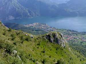
Abbadia Lariana
| Abbadia Lariana | |
|---|---|
| Comune | |
| Comune di Abbadia Lariana | |
 | |
 Abbadia Lariana Location of Abbadia Lariana in Italy | |
| Coordinates: 45°54′N 9°20′E / 45.900°N 9.333°ECoordinates: 45°54′N 9°20′E / 45.900°N 9.333°E | |
| Country | Italy |
| Region | Lombardy |
| Province | Lecco (LC) |
| Frazioni | Borbino, Castello, Chiesa Rotta, Crebbio, Linzanico, Lombrino, Molini, Novegolo, Onedo, Robianico, San Rocco, Zana |
| Government | |
| • Mayor | Rocco Cardamone |
| Area | |
| • Total | 17.1 km2 (6.6 sq mi) |
| Elevation | 204 m (669 ft) |
| Population (Dec. 2004)[1] | |
| • Total | 3,209 |
| • Density | 190/km2 (490/sq mi) |
| Demonym | Abbadiensi |
| Time zone | CET (UTC+1) |
| • Summer (DST) | CEST (UTC+2) |
| Postal code | 23821 |
| Dialing code | 0341 |
| Patron saint | St. Lawrence |
| Website | Official website |
Abbadia Lariana is a comune (municipality) in the Province of Lecco in the Italian region Lombardy, located about 50 kilometres (31 mi) northeast of Milan and about 8 kilometres (5 mi) northwest of Lecco. The village has about 3,280 inhabitants and its name is due to the presence of an abbey (abbazia in Italian) founded in the 9th century and later destroyed.
References
External links
| |||||||||||||||||||||||||||||||||||||||||
