A466 road
| |
|---|---|
|
| |
| Route information | |
| Length: | 30.0 mi[1] (48.3 km) |
| Major junctions | |
| North end: |
King's Thorn 51°59′11″N 2°44′2″W / 51.98639°N 2.73389°W |
|
| |
| South end: |
Chepstow 51°37′14.55″N 2°40′23.84″W / 51.6207083°N 2.6732889°W |
| Location | |
| Primary destinations: | Monmouth, Chepstow |
| Road network | |

The A466 is a road which runs close to the border between England and south east Wales, crossing at several locations.
Route
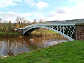
The A466 runs south from Kingsthorne, on the A49 road south east of Hereford, to the M48 motorway, junction 2, near Chepstow. It meets the A40 road at Monmouth, crossing the River Wye there and at Bigsweir Bridge near Llandogo, then follows a picturesque route south down the Wye valley through Tintern.
Places served
- Kingsthorne
- Wormelow Tump
- St Weonards
- Welsh Newton
- Buckholt
- Monmouth
- Wyesham
- Redbrook
- Llandogo
- Brockweir
- Tintern
- St Arvans
- Chepstow
References
- ↑ "Directions to A466". Google. Retrieved 14 April 2013.
External links
![]() Media related to A466 road (Great Britain) at Wikimedia Commons
Media related to A466 road (Great Britain) at Wikimedia Commons
References
| |||||||||||||||||||||