1988 Pacific typhoon season
| |
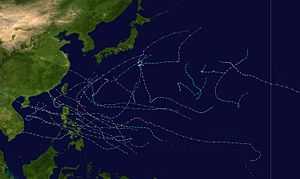
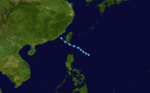
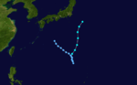
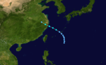
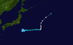
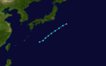
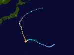
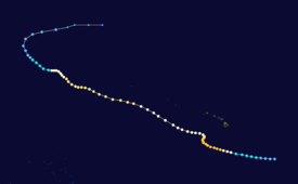
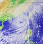
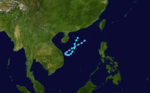
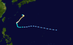
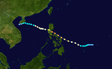
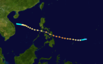
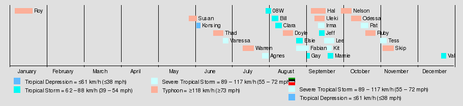
| Season summary map |
| First system formed |
January 5, 1988 |
| Last system dissipated |
December 25, 1988 |
| Strongest storm |
Nelson – 915 hPa (mbar), 185 km/h (115 mph) (10-minute sustained) |
| Total depressions |
28 |
| Total storms |
27 |
| Typhoons |
11 |
| Super typhoons |
1 |
| Total fatalities |
>542 |
| Total damage |
> $1.3 billion (1988 USD) |
Pacific typhoon seasons
1986, 1987, 1988, 1989, 1990 |
The 1988 Pacific typhoon season has no official bounds; it ran year-round in 1988, but most tropical cyclones tend to form in the northwestern Pacific Ocean between May and November.[1] These dates conventionally delimit the period of each year when most tropical cyclones form in the northwestern Pacific Ocean. Tropical Storms formed in the entire west Pacific basin were assigned a name by the Joint Typhoon Warning Center. Tropical depressions that enter or form in the Philippine area of responsibility are assigned a name by the Philippine Atmospheric, Geophysical and Astronomical Services Administration or PAGASA. This can often result in the same storm having two names.
A total of 26 tropical cyclones formed this year in the Western Pacific, of which all became tropical storms. Of the 26, 10 storms reached typhoon intensity, of which 1 reached supertyphoon strength. Nine tropical cyclones moved through the Philippines this season, making this season the most active for the archipelago so far this decade.
Storms
A total of 26 tropical cyclones formed this year in the Western Pacific, of which all became tropical storms. Of the 26, 10 storms reached typhoon intensity, of which 1 reached supertyphoon strength. Nine tropical cyclones moved through the Philippines this season.
Typhoon Roy (Asiang)
| Typhoon (JMA) |
| Category 4 typhoon (SSHWS) |
|
|
| Duration |
January 7 – January 19 |
| Peak intensity |
155 km/h (100 mph) (10-min) 940 mbar (hPa) |
Main article:
Typhoon RoyTyphoon Roy, which crossed the open Western Pacific as a Category 4 hurricane in January, caused moderate to extensive damage across the Federated States of Micronesia and the Philippines, causing $23.5 million (1988 USD) but only one death.
Typhoon Susan (Biring)
| Typhoon (JMA) |
| Category 1 typhoon (SSHWS) |
|
|
| Duration |
May 28 – June 3 |
| Peak intensity |
120 km/h (75 mph) (10-min) 970 mbar (hPa) |
Typhoon Susan formed at the end of May just to the north of Luzon Island in the Philippines. As a depression Susan dropped heavy rains in and around the Manila area the resulting landslides killed 6 people. As Susan moved away from the Philippines the storm strengthened into a typhoon shortly before cross in the southern tip of Taiwan and turning extratropical just after passing Okinawa.[2]
Tropical Depression 03W (Konsing)
| Tropical storm (PAGASA) |
| Tropical depression (SSHWS) |
|
|
| Duration |
June 3 – June 6 |
| Peak intensity |
65 km/h (40 mph) (10-min) 1000 mbar (hPa) |
Typhoon Thad (Ditang)
| Typhoon (JMA) |
| Category 1 typhoon (SSHWS) |
|
|
| Duration |
June 17 – June 25 |
| Peak intensity |
130 km/h (80 mph) (10-min) 970 mbar (hPa) |
Severe Tropical Storm Vanessa (Edeng)
| Severe tropical storm (JMA) |
| Tropical storm (SSHWS) |
|
|
| Duration |
June 25 – June 29 |
| Peak intensity |
100 km/h (65 mph) (10-min) 990 mbar (hPa) |
Typhoon Warren (Huaning)
| Typhoon (JMA) |
| Category 4 typhoon (SSHWS) |
|
|
| Duration |
July 11 – July 20 |
| Peak intensity |
165 km/h (105 mph) (10-min) 940 mbar (hPa) |
A tropical depression formed to the east of Guam shortly before passing north of the island. Shortly after passing the island the storm strengthened into Tropical Storm Warren. Warren kept gathering strength and reached peak intensity of 135 mph while 300 miles east of Luzon Island. Typhoon Warren moved westward and brushed the extreme northern tip of Luzon Island in the Philippines causing $10 million in damage. Warren then made landfall near Shantou, China, 13,000 homes were destroyed and 17 people were killed in Guangdong Province.[2]
Severe Tropical Storm Agnes
| Severe tropical storm (JMA) |
| Tropical storm (SSHWS) |
|
|
| Duration |
July 27 – August 1 |
| Peak intensity |
95 km/h (60 mph) (10-min) 975 mbar (hPa) |
Tropical Storm 08W
| Tropical storm (JMA) |
| Tropical depression (SSHWS) |
|
|
| Duration |
July 30 – August 3 |
| Peak intensity |
65 km/h (40 mph) (10-min) 998 mbar (hPa) |
Tropical Storm Bill (Isang)
| Tropical storm (JMA) |
| Tropical storm (SSHWS) |
|
|
| Duration |
August 4 – August 9 |
| Peak intensity |
85 km/h (50 mph) (10-min) 985 mbar (hPa) |
Tropical Storm Bill, which formed on August 5 east of Taiwan, moved northwest to hit eastern China as a 45 mph tropical storm. Torrential rains and heavy flooding resulted in 110 casualties and widespread damage to roads and dams.[3]
Tropical Storm Clara
| Tropical storm (JMA) |
| Tropical storm (SSHWS) |
|
|
| Duration |
August 7 – August 12 |
| Peak intensity |
75 km/h (45 mph) (10-min) 995 mbar (hPa) |
Typhoon Doyle
| Typhoon (JMA) |
| Category 4 typhoon (SSHWS) |
|
|
| Duration |
August 13 – August 21 |
| Peak intensity |
165 km/h (105 mph) (10-min) 930 mbar (hPa) |
Tropical Storm Elsie
| Tropical storm (JMA) |
| Tropical storm (SSHWS) |
|
|
| Duration |
August 24 – August 29 |
| Peak intensity |
85 km/h (50 mph) (10-min) 992 mbar (hPa) |
Severe Tropical Storm Fabian
| Severe tropical storm (JMA) |
| Category 1 typhoon (SSHWS) |
|
|
| Duration |
August 24 – September 3 |
| Peak intensity |
110 km/h (70 mph) (10-min) 970 mbar (hPa) |
Tropical Storm Gay
| Tropical storm (JMA) |
| Tropical storm (SSHWS) |
|
|
| Duration |
September 2 – September 4 |
| Peak intensity |
75 km/h (45 mph) (10-min) 995 mbar (hPa) |
Typhoon Hal
| Typhoon (JMA) |
| Category 3 typhoon (SSHWS) |
|
|
| Duration |
September 5 – September 17 |
| Peak intensity |
155 km/h (100 mph) (10-min) 945 mbar (hPa) |
This system first became a tropical depression well to the southeast of Japan, while moving to the northwest. Hal intensified into a tropical storm on September 9, and then turned southeast on September 10. Typhoon intensity was reached on September 11. Early on September 12, Hal sharply recurved, first turning to the north-northwest and eventually northeast on September 15. Accelerating northeastward, Hal became an extratropical cyclone on September 17. While the center never crossed land, two people in Honshu were reported missing with 13 others injured. As an extratropical cyclone, Hal restrengthened. By late on September 18, its central pressure had fallen to 950.0 hectopascals (28.05 inHg) and the storm was causing winds up to 72 knots (133 km/h). After peaking in strength, Hal moved through the eastern Bering Sea on September 19 and into Alaska on September 20. The weakening low moved on an anticyclonic path through southern Alaska before emerging into the Gulf of Alaska on September 23. The cyclone drifted erratically southward, dissipating in the Gulf of Alaska on September 25.[4]
Typhoon Uleki
| Typhoon (JMA) |
| Category 2 typhoon (SSHWS) |
|
|
| Duration |
September 8 (entered basin) – September 16 |
| Peak intensity |
130 km/h (80 mph) (10-min) 945 mbar (hPa) |
Uleki had developed on August 28 well to the southeast of Hawai'i and become a hurricane in the north-central Pacific before crossing the International Dateline. At 00:00 UTC on September 8, the CPHC transferred warning responsibility of Uleki to the Joint Typhoon Warning Center (JTWC) and the storm was subsequently referred to as a typhoon. Three hours later Uleki made its closest approach to Midway Atoll, passing 200 mi (320 km) to the south. Shortly thereafter the system crossed the International Dateline and the Japan Meteorological Agency (JMA) also began advising on the system.[5][6] The JMA estimated Uleki to have had a pressure of 945 mb (hPa; 27.91 inHg) at this time; however, this value was derived from satellite estimates rather than direct measurements.[6] Uleki maintained this strength through September 10 as it continued on its west-northwest course. On that day, the typhoon again entered a region of weak steering currents between two anticyclones within the subtropical ridge. A trough approaching from the west was forecast to prompt Uleki to turn east; however, the typhoon maintained a general northwest motion in a stair-stepped fashion. Increasing wind shear and cooler air soon imparted weakening,[7] and Uleki degraded to a tropical storm by September 12.[6]
Continued effects from shear stripped the cyclone of all deep convection and by September 14 only a band of cirrus clouds remained in association with Uleki. The JTWC issued their final warning on the system at 00:00 UTC that day accordingly.[7] The JMA maintained the system as a tropical depression as the former typhoon began turning to the east. Uleki later transitioned into an extratropical cyclone on September 16 as it accelerated to the east. The system dissipated the following day near the International Dateline, far from any major landmasses.[6]
Severe Tropical Storm Irma
| Severe tropical storm (JMA) |
| Tropical storm (SSHWS) |
|
|
| Duration |
September 11 – September 16 |
| Peak intensity |
100 km/h (65 mph) (10-min) 990 mbar (hPa) |
Tropical Storm Jeff (Lusing)
| Tropical storm (JMA) |
| Tropical storm (SSHWS) |
|
|
| Duration |
September 12 – September 16 |
| Peak intensity |
85 km/h (50 mph) (10-min) 995 mbar (hPa) |
Severe Tropical Storm Kit (Maring)
| Severe tropical storm (JMA) |
| Tropical storm (SSHWS) |
|
|
| Duration |
September 18 – September 22 |
| Peak intensity |
100 km/h (65 mph) (10-min) 980 mbar (hPa) |
Tropical Storm Kit formed from an area of disturbed weather 300 miles east of Manila. A depression formed on the 19th of September and strengthened into Tropical Storm Kit shortly before making landfall on the extreme northern tip of Luzon Island. Kit continued towards the northwest and made landfall 120 miles northeast of Hong Kong. Widespread flooding was reported and 3 people were killed in Guangdong Province in China.[2]
Severe Tropical Storm Lee (Ningning)
| Severe tropical storm (JMA) |
| Tropical storm (SSHWS) |
|
|
| Duration |
September 16 – September 24 |
| Peak intensity |
95 km/h (60 mph) (10-min) 990 mbar (hPa) |
Tropical Storm Mamie
| Tropical storm (JMA) |
| Tropical storm (SSHWS) |
|
|
| Duration |
September 19 – September 23 |
| Peak intensity |
85 km/h (50 mph) (10-min) 990 mbar (hPa) |
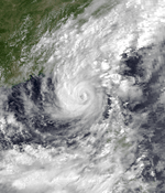
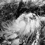
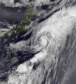
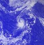
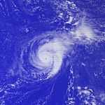
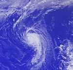
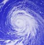
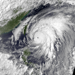
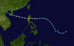
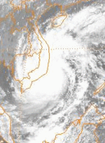
Super Typhoon Nelson (Paring)
| Typhoon (JMA) |
| Category 5 super typhoon (SSHWS) |
|
|
| Duration |
September 30 – October 8 |
| Peak intensity |
185 km/h (115 mph) (10-min) 915 mbar (hPa) |
Typhoon Odessa (Seniang)
| Typhoon (JMA) |
| Category 2 typhoon (SSHWS) |
|
|
| Duration |
October 8 – October 16 |
| Peak intensity |
130 km/h (80 mph) (10-min) 965 mbar (hPa) |
Severe Tropical Storm Pat (Toyang)
| Severe tropical storm (JMA) |
| Category 1 typhoon (SSHWS) |
|
|
| Duration |
October 16 – October 22 |
| Peak intensity |
110 km/h (70 mph) (10-min) 980 mbar (hPa) |
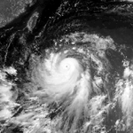
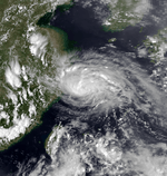
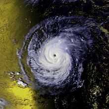
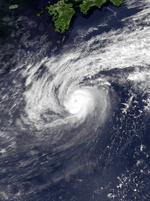
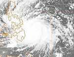
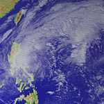
Typhoon Ruby (Unsang)
| Typhoon (JMA) |
| Category 4 typhoon (SSHWS) |
|
|
| Duration |
October 20 – October 28 |
| Peak intensity |
140 km/h (85 mph) (10-min) 950 mbar (hPa) |
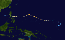
Typhoon Ruby, which developed east of the Philippines on October 20, rapidly intensified to a 145 mph typhoon while approaching central Luzon. It hit on the 24th, and rapidly weakened to a minimal typhoon over the island. Ruby, with its disrupted circulation, remained weak over the South China Sea, and land interaction with Vietnam caused it to dissipate on the 28th. Ruby caused over 300 fatalities, with widespread flooding and damage over its track. Ruby brought heavy rains and a 12 foot storm surge to Guam and the Marianas Islands. On Luzon, the storm's 140 mph (220 km/h) winds caused tremendous damage to the town of Siniloan. In the Polillo Islands, east of Manila, Ruby spawned rare tornadoes that leveled homes. In the northern part of the Philippines, many fishing boats were wrecked by 30–40 foot waves, and 32 more people drowned.[8] Damage in the Philippines totaled 5.64 billion Philippine Pesos (1989 pesos).[9]
The passenger ferry the MV Doña Marilyn was in the Visayan Sea when the storm struck the vessel. The ferry was not designed for deep water, and the open decks let water into the interior of the ship. The storm caused the ferry to pitch to the starboard until one of the decks was below the water, causing the ship to fill up rapidly. The passengers and crew tried to save the ship, but to no avail. The Doña Marilyn sank stern first taking 389 people with it. Only 147 people survived by clinging to life rafts.
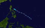
Typhoon Skip (Yoning)
| Typhoon (JMA) |
| Category 4 typhoon (SSHWS) |
|
|
| Duration |
November 3 – November 12 |
| Peak intensity |
150 km/h (90 mph) (10-min) 950 mbar (hPa) |
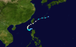
Just 2 weeks after Ruby hit Luzon, Skip, which formed on November 3, hit the central Philippines as a 145 mph typhoon. Ruby reached the South China Sea on the 7th, and steadily weakened until dissipation on the 12th. Skip was responsible for killing 104 people (with 95 missing) and extensive damage to the coconut, rice, and sugar crops.[10]
Severe Tropical Storm Tess (Welpring)
| Severe tropical storm (JMA) |
| Category 1 typhoon (SSHWS) |
|
|
| Duration |
November 1 – November 6 |
| Peak intensity |
110 km/h (70 mph) (10-min) 975 mbar (hPa) |
After passing through the Philippines, a tropical disturbance organized in the South China Sea into a tropical depression late on the morning of November 4. Turning westward and strengthening, the cyclone became a tropical storm later that day, and then a typhoon by late November 5. It moved into Vietnam on November 6 and quickly weakened, becoming the only tropical cyclone that season to make landfall in the country. Its remains later moved across the Mekong River delta.[11]
Tropical Storm Val (Apiang)
| Tropical storm (JMA) |
| Tropical storm (SSHWS) |
|
|
| Duration |
December 21 – December 25 |
| Peak intensity |
85 km/h (50 mph) (10-min) 992 mbar (hPa) |
1988 storm names
Western North Pacific tropical cyclones were named by the Joint Typhoon Warning Center. The first storm of 1988 was named Roy and the final one was named Val.
-
Andy
-
Brenda
-
Cecil
-
Dot
-
Ellis
-
Faye
-
Gordon
-
Hope
-
Irving
-
Judy
-
Ken
-
Lola
-
Mac
-
Nancy
-
Owen
-
Peggy
-
Roger
-
Sarah
-
Tip
-
Vera
-
Wayne
|
-
Abby
-
Ben
-
Carmen
-
Dom
-
Ellen
-
Forrest
-
Georgia
-
Herbert
-
Ida
-
Joe
-
Kim
-
Lex
-
Marge
-
Norris
-
Orchid
-
Percy
-
Ruth
-
Sperry
-
Thelma
-
Vernon
-
Wynn
|
-
Alex
-
Betty
-
Cary
-
Dinah
-
Ed
-
Freda
-
Gerald
-
Holly
-
Ian
-
June
-
Kelly
-
Lynn
-
Maury
-
Nina
-
Ogden
-
Phyllis
- Roy 1W
- Susan 2W
- Thad 4W
- Vanessa 5W
- Warren 6W
|
- Agnes 7W
- Bill 8W
- Clara 9W
- Doyle 10W
- Elsie 11W
- Fabian 12W
- Gay 13W
- Hal 14W
- Irma 15W
- Jeff 16W
- Kit 17W
- Lee 18W
- Mamie 19W
- Nelson 20W
- Odessa 21W
- Pat 22W
- Ruby 23W
- Skip 24W
- Tess 25W
- Val 26W
-
Winona
|
See also
References
External links
| 1980–1989 Pacific typhoon seasons |
|---|
| |
|