1987 Ecuador earthquakes
 Foreshock Mainshock | |
| Date | 6 March 1987 |
|---|---|
| Origin time | 04:10:43 UTC [1] |
| Magnitude | 7.1 Mw [1] |
| Depth | 10 km (6.2 mi) [1] |
| Epicenter | 0°04′N 77°45′W / 0.07°N 77.75°WCoordinates: 0°04′N 77°45′W / 0.07°N 77.75°W |
| Total damage | $1 billion [2] |
| Max. intensity | IX (Violent) [3] |
| Foreshocks | 6.4 Mw March 6 at 01:54 [1] |
| Aftershocks | 6.0 Mw March 6 at 08:14 [1] |
| Casualties | 5,000 [4] |
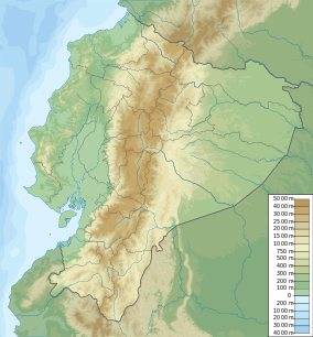
The 1987 Ecuador earthquakes occurred over a six-hour period on March 6. The sequence of shocks measured 6.7 and 7.1 and 6.0 on the moment magnitude scale. The mainshock had a maximum Mercalli Intensity of IX (Violent). The earthquakes were centered in Napo Province in northeast Ecuador; the epicenters were on the eastern slopes of the Andes, about 75 km ENE of Quito and 25 km north of Reventador Volcano. The earthquakes caused an estimated US$1 billion in damage.
See also
References
- ↑ 1.0 1.1 1.2 1.3 1.4 ISC (19 January 2015), ISC-GEM Global Instrumental Earthquake Catalogue (1900-2009), Version 2.0, International Seismological Centre
- ↑ Bolton, P. A. (1991), "Local-level economic and social consequences", The March 5, 1987, Ecuador Earthquakes: Mass Wasting and Socioeconomic Effects, National Academies Press, p. 109, ISBN 978-0309044448
- ↑ Espinoza, A. F.; Egred, J.; Garciá-Lopez, M.; Crespo, E. (1991), "Intensity and damage distribution", The March 5, 1987, Ecuador Earthquakes: Mass Wasting and Socioeconomic Effects, National Academies Press, p. 42, ISBN 978-0309044448
- ↑ USGS (September 4, 2009), PAGER-CAT Earthquake Catalog, Version 2008_06.1, United States Geological Survey
- Sources
- Kawakatsu, H.; Cadena, G. P. (1991), "Focal mechanisms of the March 6, 1987 Ecuador earthquakes—CMT inversion with a first motion constraint" (PDF), Journal of Geophysical Research (Wiley) 39: 589–597
| ||||||