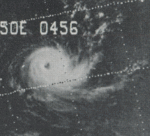
1974–75 South-West Indian Ocean cyclone season
1974–75 South-West Indian Ocean cyclone season
| |
| Season summary map |
| First system formed |
23 December 1974 |
| Last system dissipated |
22 April 1975 |
| Strongest storm |
Gervaise – 951 hPa (mbar), 280 km/h (175 mph) (1-minute sustained) |
| Total depressions |
10 |
| Total storms |
6 |
| Tropical cyclones |
5 |
| Total fatalities |
9 total |
| Total damage |
Unknown |
South-West Indian Ocean tropical cyclone seasons
1972–73, 1973–74, 1974–75, 1975–76, 1976–77 |
| Related articles |
|
|
The 1974–75 South-West Indian Ocean cyclone season was a below-average cyclone season. The season officially ran from November 1, 1974, to April 30, 1975.
Storms
Tropical Disturbance Adele
| Tropical disturbance (MFR) |
|
|
| Duration |
December 23 – December 24 |
| Peak intensity |
45 km/h (30 mph) (10-min) |
Cyclone Blandine
| Category 3 tropical cyclone (SSHWS) |
|
|
| Duration |
January 6 – January 12 |
| Peak intensity |
185 km/h (115 mph) (1-min) 980 mbar (hPa) |
Cyclone Camille
| Severe tropical storm (MFR) |
| Category 1 tropical cyclone (SSHWS) |
|
|
| Duration |
January 10 – January 21 |
| Peak intensity |
110 km/h (70 mph) (10-min) 995 mbar (hPa) |
This system formed southeast of the Seychelles on January 7 before becoming disorganized while interacting with northern Madagascar. The system redeveloped as a hurricane-force cyclone in the northern Mozambique Channel on January 16 before moving southeast into Madagascar on January 19.[1]
Cyclone Robyn-Deborah
| Tropical cyclone (MFR) |
| Category 3 tropical cyclone (SSHWS) |
|
|
| Duration |
January 14 – January 24 |
| Peak intensity |
130 km/h (80 mph) (10-min) 960 mbar (hPa) |
Tropical Depression Elsa
| Tropical depression (MFR) |
|
|
| Duration |
January 25 – January 27 |
| Peak intensity |
55 km/h (35 mph) (10-min) |
Tropical Disturbance Fernande
| Tropical disturbance (MFR) |
|
|
| Duration |
February 1 – February 1 |
| Peak intensity |
45 km/h (30 mph) (10-min) |
This storm lasted for only 18 hours on February 1.
Cyclone Gervaise
| Tropical cyclone (MFR) |
| Category 1 tropical cyclone (SSHWS) |
|
|
| Duration |
February 1 – February 10 |
| Peak intensity |
120 km/h (75 mph) (10-min) 951 mbar (hPa) |
Intense tropical cyclone Gervaise formed on 1 February 1975 in the south of Diego Garcia. On the following day, the cyclone started to intensify gradually producing waves of 15 m high. The cyclone was moving in a west-south-west direction towards Madagascar when suddenly on 4 February 1975, the cyclone curved to a south-south-west direction, showing a potential danger to the Island of Mauritius. On 5 February 1975, the intense tropical cyclone Gervaise approached Mauritius where its eye was centered on the island on the morning of the 6th February 1975. Calm weather prevailed on the island from 09.30hr till 13hr30 and later the weather started to deteriorate again with average wind speeds over 200kmh for approx 12 hours either side of the eye and maximum gusts of 280 km/h until 2 o'clock in the morning of the 7th of February. It caused substantial damage to properties, vegetation and wildlife. Moored yachts around the coast were washed hundreds of yards inland in places due to the storm surge and in the capital Port Louis, a cargo ship of ca. 10,000 tonnes was washed up on to the quay. 6 deaths - 34 injured, 3,706 homeless.
Cyclone Heloise
| Tropical depression (MFR) |
| Tropical depression (SSHWS) |
|
|
| Duration |
February 19 – February 26 |
| Peak intensity |
55 km/h (35 mph) (10-min) 985 mbar (hPa) |
Cyclone Ines
| Tropical storm (SSHWS) |
|
|
| Duration |
March 9 – March 19 |
| Peak intensity |
100 km/h (65 mph) (1-min) 985 mbar (hPa) |
Tropical Depression Junon
| Tropical depression (MFR) |
|
|
| Duration |
April 18 – April 22 |
| Peak intensity |
55 km/h (35 mph) (10-min) |
See also
- Atlantic hurricane seasons: 1974, 1975
- Eastern Pacific hurricane seasons: 1974, 1975
- Western Pacific typhoon seasons: 1974, 1975
- North Indian Ocean cyclone seasons: 1974, 1975
References
- ↑ Dick DeAngelis. "Hurricane Alley". Mariners Weather Log 19 (3): 154.
| 1970–1979 South-West Indian Ocean cyclone seasons |
|---|
| |
|


