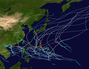
1963 Pacific typhoon season
1963 Pacific typhoon season
| |
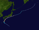
| Season summary map |
| First system formed |
March 25, 1963 |
| Last system dissipated |
December 28, 1963 |
| Strongest storm |
Judy – 920 hPa (mbar), 280 km/h (175 mph) (1-minute sustained) |
| Total depressions |
36 |
| Total storms |
25 |
| Typhoons |
19 |
| Super typhoons |
8 |
| Total fatalities |
Unknown |
| Total damage |
Unknown |
Pacific typhoon seasons
1961, 1962, 1963, 1964, 1965 |
The 1963 Pacific typhoon season has no official bounds; it ran year-round in 1963, but most tropical cyclones tend to form in the northwestern Pacific Ocean between June and December. These dates conventionally delimit the period of each year when most tropical cyclones form in the northwestern Pacific Ocean.
The scope of this article is limited to the Pacific Ocean, north of the equator and west of the international date line. Storms that form east of the date line and north of the equator are called hurricanes; see 1963 Pacific hurricane season. Tropical Storms formed in the entire west pacific basin were assigned a name by the Joint Typhoon Warning Center. Tropical depressions in this basin have the "W" suffix added to their number. Tropical depressions that enter or form in the Philippine area of responsibility are assigned a name by the Philippine Atmospheric, Geophysical and Astronomical Services Administration or PAGASA. This can often result in the same storm having two names. This was the first season in which PAGASA assigned local names to typhoons.[1]
Storms
36 tropical depressions formed this year in the Western Pacific, of which 25 became tropical storms. 19 storms reached typhoon intensity, of which 8 reached super typhoon strength.[2]
Tropical Depression 03W
| Tropical depression (SSHWS) |
|
|
| Duration |
March 25 – March 26 |
| Peak intensity |
45 km/h (30 mph) (1-min) |
CMA Tropical Depression 1
| Tropical depression (JMA) |
|
|
| Duration |
March 31 – April 6 |
| Peak intensity |
55 km/h (35 mph) (10-min) 1001 mbar (hPa) |
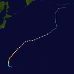
Typhoon Olive
| Category 4 typhoon (SSHWS) |
|
|
| Duration |
April 26 – May 5 |
| Peak intensity |
230 km/h (145 mph) (1-min) 920 mbar (hPa) |
Typhoon Polly (Auring)
| Category 1 typhoon (SSHWS) |
|
|
| Duration |
May 27 – June 5 |
| Peak intensity |
130 km/h (80 mph) (1-min) 978 mbar (hPa) |
Tropical Storm Rose (Bebeng)
| Tropical storm (SSHWS) |
|
|
| Duration |
June 6 – June 14 |
| Peak intensity |
95 km/h (60 mph) (1-min) 992 mbar (hPa) |
Typhoon Shirley (Karing)
| Category 5 super typhoon (SSHWS) |
|
|
| Duration |
June 12 – June 20 |
| Peak intensity |
260 km/h (160 mph) (1-min) 935 mbar (hPa) |
Typhoon Trix (Diding)
| Category 1 typhoon (SSHWS) |
|
|
| Duration |
June 15 – July 2 |
| Peak intensity |
130 km/h (80 mph) (1-min) 984 mbar (hPa) |
Tropical Storm Virginia (Etang)
| Tropical storm (SSHWS) |
|
|
| Duration |
July 1 – July 9 |
| Peak intensity |
95 km/h (60 mph) (1-min) 990 mbar (hPa) |
Typhoon Wendy (Herming)
| Category 4 super typhoon (SSHWS) |
|
|
| Duration |
July 9 – July 20 |
| Peak intensity |
250 km/h (155 mph) (1-min) 930 mbar (hPa) |
CMA Tropical Depression 09
| Tropical depression (CMA) |
|
|
| Duration |
July 11 – July 13 |
| Peak intensity |
55 km/h (35 mph) (10-min) 1002 mbar (hPa) |
Typhoon Agnes (Ising)
| Category 2 typhoon (SSHWS) |
|
|
| Duration |
July 15 – July 24 |
| Peak intensity |
155 km/h (100 mph) (1-min) 992 mbar (hPa) |
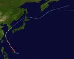
Typhoon Bess
| Category 4 super typhoon (SSHWS) |
|
|
| Duration |
July 25 – August 11 |
| Peak intensity |
240 km/h (150 mph) (1-min) 930 mbar (hPa) |
On July 27 Tropical Depression 20W formed in the West Pacific. It drifted northward, reaching tropical storm on the 30th before turning to the southwest. Bess turned to the north on August 2, and reached typhoon status early on the 3rd. Bess rapidly intensified to a peak of 150 mph on the 4th, but weakened as it continued northward. On the 9th it struck Japan, and on the 11th Bess became extratropical. At the time, Bess had the longest longevity of a Western Pacific tropical cyclone.
Typhoon Bess caused severe damage on the island of Kyūshū. 23 people were killed and 6 were missing.[3]
Tropical Storm 21W
| Tropical storm (SSHWS) |
|
|
| Duration |
July 29 – August 2 |
| Peak intensity |
65 km/h (40 mph) (1-min) 997 mbar (hPa) |
Typhoon Carmen (Luding)
| Category 4 typhoon (SSHWS) |
|
|
| Duration |
August 8 – August 18 |
| Peak intensity |
230 km/h (145 mph) (1-min) 930 mbar (hPa) |
CMA Tropical Depression 14
| Tropical depression (CMA) |
|
|
| Duration |
August 21 – August 23 |
| Peak intensity |
55 km/h (35 mph) (10-min) 1001 mbar (hPa) |
Typhoon Elaine
| Category 3 typhoon (SSHWS) |
|
|
| Duration |
August 23 – August 27 |
| Peak intensity |
185 km/h (115 mph) (1-min) 965 mbar (hPa) |
Typhoon Della
| Category 3 typhoon (SSHWS) |
|
|
| Duration |
August 23 – August 29 |
| Peak intensity |
185 km/h (115 mph) (1-min) 975 mbar (hPa) |
Typhoon Faye (Neneng)
| Category 3 typhoon (SSHWS) |
|
|
| Duration |
August 28 – September 11 |
| Peak intensity |
205 km/h (125 mph) (1-min) 960 mbar (hPa) |
Typhoon Faye struck Hong Kong killing 3 people.[4]
CMA Tropical Depression 17
| Tropical depression (CMA) |
|
|
| Duration |
August 28 – August 31 |
| Peak intensity |
55 km/h (35 mph) (10-min) 997 mbar (hPa) |
Tropical Depression 26W
| Tropical depression (SSHWS) |
|
|
| Duration |
August 26 – August 26 |
| Peak intensity |
45 km/h (30 mph) (1-min) |
CMA Tropical Depression 19
| Tropical depression (CMA) |
|
|
| Duration |
September 1 – September 2 |
| Peak intensity |
45 km/h (30 mph) (10-min) 1002 mbar (hPa) |
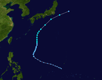
Typhoon Gloria (Oniang)
| Category 4 super typhoon (SSHWS) |
|
|
| Duration |
September 3 – September 15 |
| Peak intensity |
250 km/h (155 mph) (1-min) 920 mbar (hPa) |
Typhoon Gloria, which developed on September 5 in the open waters of the West Pacific, rapidly intensified to a peak of 155 mph on the 9th. It weakened as it continued west-northwestward, and hit extreme northeastern Taiwan on the 11th as a 100 mph typhoon. It caused severe flooding in Northern Taiwan and hundreds of casualties. Gloria continued westward, and hit eastern China that night as an 85 mph typhoon. The storm looped over land to the northeast, and dissipated on the 13th to the east of China. Gloria caused 239 casualties, with 89 missing.
Tropical Storm Hester (Pepang)
| Tropical storm (SSHWS) |
|
|
| Duration |
September 7 – September 13 |
| Peak intensity |
85 km/h (50 mph) (1-min) 998 mbar (hPa) |
Tropical Storm Irma
| Tropical storm (SSHWS) |
|
|
| Duration |
September 16 – September 19 |
| Peak intensity |
75 km/h (45 mph) (1-min) 1002 mbar (hPa) |
Typhoon Judy
| Category 5 super typhoon (SSHWS) |
|
|
| Duration |
September 27 – October 4 |
| Peak intensity |
280 km/h (175 mph) (1-min) 920 mbar (hPa) |
CMA Tropical Depression 25
| Tropical depression (CMA) |
|
|
| Duration |
October 2 – October 3 |
| Peak intensity |
45 km/h (30 mph) (10-min) 1005 mbar (hPa) |
Typhoon Kit (Rosing)
| Category 4 super typhoon (SSHWS) |
|
|
| Duration |
October 3 – October 11 |
| Peak intensity |
250 km/h (155 mph) (1-min) 930 mbar (hPa) |
Typhoon Lola
| Category 4 super typhoon (SSHWS) |
|
|
| Duration |
October 6 – October 19 |
| Peak intensity |
240 km/h (150 mph) (1-min) 943 mbar (hPa) |
Typhoon Mamie
| Category 3 typhoon (SSHWS) |
|
|
| Duration |
October 13 – October 18 |
| Peak intensity |
185 km/h (115 mph) (1-min) 965 mbar (hPa) |
Tropical Storm Nina
| Tropical storm (SSHWS) |
|
|
| Duration |
October 18 – October 20 |
| Peak intensity |
75 km/h (45 mph) (1-min) 1000 mbar (hPa) |
Typhoon Ora
| Category 1 typhoon (SSHWS) |
|
|
| Duration |
October 22 – October 30 |
| Peak intensity |
150 km/h (90 mph) (1-min) 985 mbar (hPa) |
Typhoon Phyllis (Sisang)
| Category 1 typhoon (SSHWS) |
|
|
| Duration |
December 8 – December 15 |
| Peak intensity |
140 km/h (85 mph) (1-min) 994 mbar (hPa) |
Tropical Storm Rita (Trining)
| Tropical storm (SSHWS) |
|
|
| Duration |
December 15 – December 19 |
| Peak intensity |
75 km/h (45 mph) (1-min) 998 mbar (hPa) |
Typhoon Susan
| Category 4 super typhoon (SSHWS) |
|
|
| Duration |
December 18 – December 28 |
| Peak intensity |
250 km/h (155 mph) (1-min) 935 mbar (hPa) |
1963 storm names
- Agnes 18W
- Bess 20W
- Carmen 23W
- Della 25W
- Elaine 27W
- Faye 28W
- Gloria 29W
- Hester 30W
- Irma 32W
- Judy 34W
- Kit 35W
- Lola 36W
- Mamie 37W
- Nina 38W
- Ora 39W
- Phyllis 41W
- Rita 42W
- Susan 43W
-
Tess
-
Viola
-
Winnie
|
-
Alice
-
Betty
-
Cora
-
Doris
-
Elsie
-
Flossie
-
Grace
-
Helen
-
Ida
-
June
-
Kathy
-
Lorna
-
Marie
-
Nancy
-
Olga
-
Pamela
-
Ruby
-
Sally
-
Tilda
-
Violet
-
Wilda
|
-
Anita
-
Billie
-
Clara
-
Dot
-
Ellen
-
Fran
-
Georgia
-
Hope
-
Iris
-
Joan
-
Kate
-
Louise
-
Marge
-
Nora
-
Opal
-
Patsy
-
Ruth
-
Sarah
-
Thelma
-
Vera
-
Wanda
|
-
Amy
-
Babe
-
Carla
-
Dinah
-
Emma
-
Freda
-
Gilda
-
Harriet
-
Ivy
-
Jean
-
Kim
-
Lucy
-
Mary
-
Nadine
- Olive 5W
- Polly 9W
- Rose 10W
- Shirley 11W
- Trix 12W
- Virginia 15W
- Wendy 16W
|
See also
References
- ↑ http://www.philstar.com/headlines/215695/after-%C2%91harurot%C2%92-%C2%91kabayan%C2%92-%C2%91onyok%C2%92-%C2%91pogi%C2%92-coming
- ↑ 1963 ATCR TABLE OF CONTENTS
- ↑ Digital Typhoon: Typhoon List (1963)
- ↑ Historical Information
External links
| 1960–1969 Pacific typhoon seasons |
|---|
| |
|
