1906 Ecuador–Colombia earthquake
| Date | January 31, 1906 |
|---|---|
| Magnitude | 8.8 Magnitude Mw |
| Epicenter | 1°00′N 81°30′W / 1.0°N 81.5°WCoordinates: 1°00′N 81°30′W / 1.0°N 81.5°W |
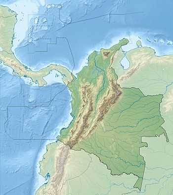
| Areas affected | Ecuador, Colombia |
| Tsunami |
5 m (16 ft) [1] 53 runups [1] |
| Casualties | ~1,000 |
The 1906 Ecuador–Colombia earthquake occurred at 15:36 UTC on January 31, off the coast of Ecuador, near Esmeraldas. The earthquake had a magnitude of 8.8 and triggered a destructive tsunami that caused at least 500 casualties on the coast of Colombia.
Tectonic setting
The earthquake occurred along the boundary between the Nazca Plate and the South American Plate. The earthquake is likely to be a result of thrust-faulting, caused by the subduction of the Nazca plate beneath the South American plate. The coastal parts of Ecuador and Colombia have a history of great megathrust earthquakes originating from this plate boundary.
Damage
The greatest damage from the tsunami occurred on the coast between Río Verde, Ecuador and Micay, Colombia. Estimates of the number of deaths caused by the tsunami vary between 500 and 1,500.[2]
Characteristics
Earthquake
The rupture zone for this earthquake was 500–600 km (310–370 mi) long, and encompassed those for the earthquakes of 1942 (Mw=7.8), 1958 (Mw=7.7) and 1979 (Mw=8.2). The lack of overlap between the three more recent events suggest the presence of minor barriers to rupture propagation along the plate boundary.[3][4] Although these three events ruptured the same area of the plate boundary overall, they released only a small fraction of the energy of the 1906 earthquake.[5]
Tsunami
The maximum recorded run-up height was 5 m (16 ft) in Tumaco, Colombia. At Hilo, Hawaii a 1.8 m (5 ft 11 in) run-up height was recorded for this event. The tsunami was also noted in Costa Rica, Panama, Mexico, California and Japan.[2]
Future seismic hazard
Because the sequence of three earthquakes that ended in 1979 did not release as much energy as the 1906 event, it has been suggested that an earthquake of similar magnitude to that in 1906 was likely in the near future. However, analysis of the amount of slip associated with the three later events suggest that they have released most of the accumulated displacement across the plate boundary since 1906.[5]
See also
- Earthquakes in 1906
- List of earthquakes in Colombia
- List of earthquakes in Ecuador
References
- ↑ 1.0 1.1 USGS (September 4, 2009), PAGER-CAT Earthquake Catalog, Version 2008_06.1, United States Geological Survey
- ↑ 2.0 2.1 NGDC. "Comments for the Ecuador-Columbia tsunami". Retrieved 7 March 2010.
- ↑ Kanamori, H.; McNally K.C. (1982). "Variable rupture model of the subduction zone along the Ecuador-Colombia coast" (PDF). Bulletin of the Seismological Society of America (Seismological Society of America) 72 (4): 1241–1253. Retrieved 26 August 2012.
- ↑ Mendoza, C.; Dewey J.W. (1984). "Seismicity associated with the great Colombia-Ecuador earthquakes of 1942, 1958, and 1979: Implications for barrier models of earthquake rupture". Bulletin of the Seismological Society of America 74 (2): 577–593. Retrieved 2010-03-07.
- ↑ 5.0 5.1 White, S.M.M.; Trenkamp R. & Kellogg J.N. (2003). "Recent crustal deformation and the earthquake cycle along the Ecuador-Colombia subduction zone" (PDF). Earth and Planetary Science Letters 216 (3): 231–242. Bibcode:2003E&PSL.216..231W. doi:10.1016/S0012-821X(03)00535-1. Retrieved 2010-03-07.
| ||||||||||||||