1892 Atlantic hurricane season
| |
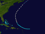
| Season summary map |
| First storm formed |
June 9, 1892 |
| Last storm dissipated |
October 29, 1892 |
| Strongest storm |
Three, Five, and Seven – 85 knots (157 km/h) |
| Total storms |
9 |
| Major storms (Cat. 3+) |
0 |
| Total damage |
Unknown |
| Total fatalities |
16 |
Atlantic hurricane seasons
1890, 1891, 1892, 1893, 1894 |
The 1892 Atlantic hurricane season ran through the summer and the first half of fall in 1892. The season accumulated nine tropical storms, five hurricanes, but no major hurricanes.With an Accumulated Cyclone Energy of 116, this was an above average season. Three tropical storms made landfall on the United States. However, due to scarce technology and the fact that only storms that affected land or ships were recorded, the actual total could be higher.
Storms
Tropical Storm One
| Tropical storm (SSHWS) |
|
|
| Duration |
June 9 – June 16 |
| Peak intensity |
50 mph (85 km/h) (1-min) ≤1005 mbar (hPa) |
The first storm of the season formed south of Isla de la Juventud on June 19. It made landfalls in Cuba and Florida before dissipating south of North Carolina on June 16. In Florida, the cyclone produced significant rainfall between Titusville and Hypoluxo, with Hypoluxo recording 3.6 inches (91.44 mm) in just a few hours. Titusville measured 12.95 in (328.93 mm) over a period lasting six days.[1]
Hurricane Two
| Category 1 hurricane (SSHWS) |
|
|
| Duration |
August 15 – August 21 |
| Peak intensity |
75 mph (120 km/h) (1-min) |
On August 15, a tropical storm was first seen in the open Atlantic east of the Leeward Islands. It tracked northwestward, becoming a hurricane on August 19 before becoming extratropical on August 21. The extratropical storm hit Newfoundland, and completely lost its identity on August 24.
Hurricane Three
| Category 2 hurricane (SSHWS) |
|
|
| Duration |
September 3 – September 17 |
| Peak intensity |
100 mph (155 km/h) (1-min) |
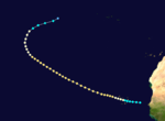
The third hurricane of the year was a long-lasting storm that formed southwest of the Cape Verde islands on September 3. The unnamed storm did not affect land, peaking at 100 mph (160 km/h) before dissipating northeast of the Azores islands near Spain on September 17.
Tropical Storm Four
| Tropical storm (SSHWS) |
|
|
| Duration |
September 8 – September 13 |
| Peak intensity |
60 mph (95 km/h) (1-min) |
On September 8, the fourth tropical storm formed in the southwestern Gulf of Mexico northwest of Campeche. After tracking to the northeast, it made landfalls near New Orleans, Louisiana, and near the Louisiana-Mississippi state lines as a moderate tropical storm. On September 13 the storm became extratropical over Tennessee, and lost its identity on September 17 near Greenland.
Hurricane Five
| Category 2 hurricane (SSHWS) |
|
|
| Duration |
September 12 – September 23 |
| Peak intensity |
100 mph (155 km/h) (1-min) |
First recorded east of the Cape Verde islands on September 12, the hurricane only affected the islands without officially making landfall before dissipating in the open Atlantic near 37°N 40°W on September 23.
Tropical Storm Six
| Tropical storm (SSHWS) |
|
|
| Duration |
September 25 – September 27 |
| Peak intensity |
60 mph (95 km/h) (1-min) |
The sixth tropical storm of the season was a very short-lived storm that was first recorded northwest of Ciudad del Carmen on September 25. The storm travelled northwest across the Bay of Campeche before making landfall near the Mexico-Texas border, dissipating inland on September 27.
Hurricane Seven
| Category 2 hurricane (SSHWS) |
|
|
| Duration |
October 5 – October 16 |
| Peak intensity |
100 mph (155 km/h) (1-min) |
On October 5, the seventh storm of the season formed east of Trinidad and Tobago. It made landfalls on Paraguaná, Guajira, and near Cabo Gracias a Dios on the Nicaragua – Honduras border. It dissipated inland on October 16.
Hurricane Eight
| Category 1 hurricane (SSHWS) |
|
|
| Duration |
October 13 – October 17 |
| Peak intensity |
90 mph (150 km/h) (1-min) |
The eighth storm of the season formed northeast of the Bahamas on October 13, and briefly threatened Bermuda. However, it never made landfall before becoming extratropical in the open Atlantic on October 18.
Tropical Storm Nine
| Tropical storm (SSHWS) |
|
|
| Duration |
October 21 – October 29 |
| Peak intensity |
50 mph (85 km/h) (1-min) |
The ninth and final tropical storm of the season formed northwest of the Yucatán Peninsula on October 21. It made its single landfall near Tampa, Florida, as a tropical storm. It then tracked east over Central Florida, turned northeast, and lost its identity on October 29 in the open Atlantic.
See also
References
- ↑ "Observed Rainfall in Florida, Monthly Totals from Beginning of Records to 31 December 1947". Tallahassee, Florida: Division of Water Survey and Research, State of Florida, State Board of Conservation. 1948.
External links


