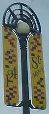
124 Street, Edmonton
 | |
|---|---|
| Maintained by | the City of Edmonton |
| Length | 4.6 km (2.9 mi) |
| Location | Edmonton |
| South end | Jasper (101) Avenue |
| Major junctions | 102 Avenue, 107 Avenue, 111 Avenue, 118 Avenue, Yellowhead Trail |
| North end |
CN Yards south property line (0.3 km (0.19 mi) north of Yellowhead Trail) |

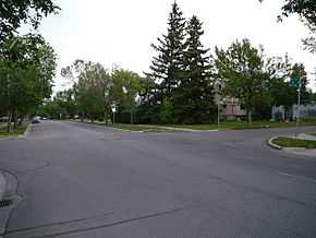
124 Street in Prince Charles.
124 Street is an arterial road in north-central Edmonton, Alberta, Canada. It is one route for commuters from Downtown Edmonton to north Edmonton.
It is home to a variety of shops between Jasper Avenue and 107 Avenue, most notably the galleries of the Gallery Walk.
Neighbourhoods
List of neighbourhoods 124 Street runs through, in order from south to north.[1]
Interchanges and intersections
This is a list of major intersections, starting at the south end of 124 Street.[1]
| Direction | Intersecting road | Current intersection type | Coordinates |
|---|---|---|---|
| South-North | Jasper (101) Avenue | At-grade | 53°32′29″N 113°32′9″W / 53.54139°N 113.53583°W |
| 102 Avenue | At-grade (traffic lights) | 53°32′35″N 113°32′9″W / 53.54306°N 113.53583°W | |
| Stony Plain Road | At-grade (traffic lights) | 53°32′49″N 113°32′9″W / 53.54694°N 113.53583°W | |
| 107 Avenue | At-grade (traffic lights) | 53°33′3″N 113°32′9″W / 53.55083°N 113.53583°W | |
| 111 Avenue | At-grade (traffic lights) | 53°33′32″N 113°32′9″W / 53.55889°N 113.53583°W | |
| 114 Avenue | At-grade | 53°33′49″N 113°32′9″W / 53.56361°N 113.53583°W | |
| 118 Avenue (to Kingsway Avenue) | At-grade (traffic lights) | 53°34′13″N 113°32′9″W / 53.57028°N 113.53583°W | |
| Yellowhead Trail | At-grade (traffic lights) | 53°34′50″N 113°32′9″W / 53.58056°N 113.53583°W | |
| Yellowhead Corridor alley | At-grade | 53°35′0″N 113°32′9″W / 53.58333°N 113.53583°W |
References
- ↑ 1.0 1.1 "City of Edmonton map utility". Archived from the original on 2009-06-25. Retrieved 2009-06-23.
| ||||||||||||||||||||||||||||||
| |||||||||||||||||||||||||||||||||
