's-Gravendeel
Coordinates: 51°47′N 4°37′E / 51.783°N 4.617°E
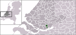
Location of former municipality.
![]() 's-Gravendeel () is a town and former municipality in the western Netherlands, in the province of South Holland. The former municipality covered an area of 20.69 km² (7.99 mile²) of which 1.77 km² (0.68 mile²) is water.Its population was 9,023 in January 2007.
's-Gravendeel () is a town and former municipality in the western Netherlands, in the province of South Holland. The former municipality covered an area of 20.69 km² (7.99 mile²) of which 1.77 km² (0.68 mile²) is water.Its population was 9,023 in January 2007.
The municipality of 's-Gravendeel was merged with Binnenmaas on January 1, 2007.
's-Gravendeel is on the eastern side of Hoeksche Waard Island on the river Dordtsche Kil. It is connected to Dordrecht by means of the Kil Tunnel. The village was founded in 1593 when the new polder Nieuw-Bonaventura was drained.
-

Reformed church
-

Windmill: korenmolen het Vliegend Hert
-

Reformed church in 's-Gravendeel with its notable church moat
External links
| Wikimedia Commons has media related to 's-Gravendeel. |