Žalec
| Žalec | |
|---|---|
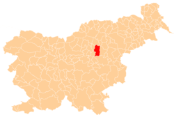
_location_map.svg.png) Žalec Location in Slovenia | |
| Coordinates: 46°15′3.59″N 15°9′50.18″E / 46.2509972°N 15.1639389°ECoordinates: 46°15′3.59″N 15°9′50.18″E / 46.2509972°N 15.1639389°E | |
| Country |
|
| Traditional region | Styria |
| Statistical region | Savinja |
| Municipality | Žalec |
| Area | |
| • Total | 3.0 km2 (1.2 sq mi) |
| Elevation | 255.3 m (837.6 ft) |
| Population (2013) | |
| • Total | 4,878 |
| [1] | |
Žalec is a town and in central Slovenia. It is the seat of the Municipality of Žalec. It lies in the valley of the lower course of the Savinja River west of Celje. The primary economic activity of the region is growing hops, which is reflected by the city's coat-of-arms. The area was part of the traditional region of Styria. The municipality is now included in the Savinja Statistical Region.[2]
The parish church in the settlement is dedicated to Saint Nicholas and belongs to the Roman Catholic Diocese of Celje. It was built between 1903 and 1906 on the site of a 16th-century church. The 16th-century building had a walled enclosure to protect the locals against Ottoman raids. A round tower from this enclosure still stands next to the church.[3]
References
- ↑ Statistical Office of the Republic of Slovenia
- ↑ Žalec municipal site
- ↑ Slovenian Ministry of Culture register of national heritage reference numbers ešd 3537 & 10470
External links
 Media related to Žalec at Wikimedia Commons
- Žalec on Geopedia
| ||||||||||||||||||