Šmaver, Nova Gorica
| Šmaver | |
|---|---|
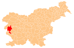
_location_map.svg.png) Šmaver Location in Slovenia | |
| Coordinates: 46°0′13.27″N 13°37′21.75″E / 46.0036861°N 13.6227083°ECoordinates: 46°0′13.27″N 13°37′21.75″E / 46.0036861°N 13.6227083°E | |
| Country | Slovenia |
| Traditional region | Slovenian Littoral |
| Statistical region | Gorizia |
| Municipality | Nova Gorica |
| Area | |
| • Total | 4 km2 (2 sq mi) |
| Elevation | 291.2 m (955.4 ft) |
| Population (2002) | |
| • Total | 0 |
| [1] | |
Šmaver (pronounced [ˈʃmaːvər]; Italian: San Mauro) is a settlement on the right bank of the Soča River north of Solkan in the municipality of Nova Gorica in western Slovenia.[2]
Name
Locally, Šmaver is known as Štamaver or Šentmaver.[3]
History
The actual settlement of San Mauro remained in Italy, whereas the area of Šmaver with the eastern slopes of Mount Sabotin, now without any permanent residents, was annexed to the Socialist Federal Republic of Yugoslavia in 1947.
References
- ↑ Statistical Office of the Republic of Slovenia
- ↑ Nova Gorica municipal site
- ↑ Jakopin, Franc, et al. 1985. Slovenska krajevna imena. Ljubljana: Cankarjeva založba, pp. 292–293.
External links
| ||||||||||||||||||||||||||