Škocjan
| Škocjan | |
|---|---|
|
Postcard of Škocjan | |
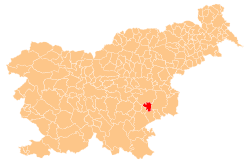
_location_map.svg.png) Škocjan Location in Slovenia | |
| Coordinates: 45°54′24.67″N 15°17′29.09″E / 45.9068528°N 15.2914139°ECoordinates: 45°54′24.67″N 15°17′29.09″E / 45.9068528°N 15.2914139°E | |
| Country |
|
| Traditional region | Lower Carniola |
| Statistical region | Southeast Slovenia |
| Municipality | Škocjan |
| Area | |
| • Total | 2.0 km2 (0.8 sq mi) |
| Elevation | 170.4 m (559.1 ft) |
| Population (2002) | |
| • Total | 233 |
| [1] | |

Škocjan (pronounced [ˈʃkɔːtsjan]; German: Sankt Cantian)[2] is a settlement in the traditional region of Lower Carniola in southeastern Slovenia. It is the seat of the Municipality of Škocjan. It should not be confused with Škocjan Caves, which is located in a different part of the country, near Divača. The Municipality of Škocjan is now included in the Southeast Slovenia Statistical Region.[3]
Vrh Estate
The Vrh Estate (in older sources also Kolešnik,[2] German: Auenthal[2]) stands 1 km west of Škocjan. By the 20th century it was reduced to a large farm owned by the Rupar family of Goriška Vas pri Škocjanu.[4] The manor was built before 1667 by Wolfgang Blande. It passed through many owners over the following centuries and was purchased by the Rupar family in 1928.[5]
Church
The local parish church from which the settlement gets its name is dedicated to Saint Cantius and belongs to the Roman Catholic Diocese of Novo Mesto. It is a medieval building that was extended in the 17th century and restyled in the Baroque style in the 18th century.[6]
References
- ↑ Statistical Office of the Republic of Slovenia
- ↑ 2.0 2.1 2.2 Leksikon občin kraljestev in dežel zastopanih v državnem zboru, vol. 6: Kranjsko. 1906. Vienna: C. Kr. Dvorna in Državna Tiskarna, pp. 82–83.
- ↑ Škocjan municipal site
- ↑ Savnik, Roman, ed. 1971. Krajevni leksikon Slovenije, vol. 2. Ljubljana: Državna založba Slovenije, p. 536.
- ↑ Gradovi v Sloveniji: Vrh (Slovene)
- ↑ "EŠD 2503". Registry of Immovable Cultural Heritage (in Slovenian). Ministry of Culture of the Republic of Slovenia. Retrieved 27 May 2011.
External links
-
 Media related to Škocjan at Wikimedia Commons
 - Škocjan municipal site
- Škocjan at Geopedia
| ||||||||||||||||