Šangaj

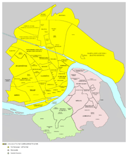
Šangaj (Serbian Cyrillic: Шангај) is a neighborhood and local community of northeastern Novi Sad, in the Vojvodina province of Serbia. It is situated close to the Danube, and is completely surrounded by the Novi Sad industrial zones, right next to the oil refinery of Naftna Industrija Srbije. It covers an area of 0.13 km².
Name
The old name of the area was Vrbak. In the Interwar period, the name of the settlement was Brančićevo Naselje ("Brančić's settlement"), named after Brančić who was the owner of the Šangaj snack bar, the first building built there. "Šangaj" was later adopted as the official name. The name Šangaj itself is the Serbian transliteration for Shanghai, the largest city of the People's Republic of China.
History
From the 1980s, city authorities tried to relocate the neighborhood, due to high pollution of the nearby oil refinery.
Šangaj was located on the old road to Kać, which was closed in the early 1990s.
Devastated by NATO bombardment, during the Kosovo War of 1999, Šangaj was hit severely when oil refinery was bombed several times, causing severe pollution and widespread ecological damage (See: 1999 NATO bombing in Novi Sad).
Population
In mid-2005, neighborhood had 1,827 inhabitants, according to the estimation from city's registry. The majority of the population are ethnic Romani, while a smaller part of population are Serbs. In mid-2010, neighborhood now have 2500 inhabitants, according to the estimation from city's registry. The majority of the population are now Serbs, while a smaller part of population are Romani.
Transportation
Šangaj has only one road from and to the neighborhood, from Kaćki most ("Kać bridge") over Danube-Tisa-Danube Canal. Neighborhood is connected to the rest of the city by only one bus line, No. 21, from Banatić neighborhood.
References
- Milorad Grujić, Vodič kroz Novi Sad i okolinu, Novi Sad, 2004.
- Jovan Mirosavljević, Novi Sad - atlas ulica, Novi Sad, 1998.
External links
- Neighborhoods of Novi Sad
- Map of Novi Sad
- About Šangaj (in Serbian)
| ||||||||||||||||||||
Coordinates: 45°16′19″N 19°52′33″E / 45.27194°N 19.87583°E
