Újbuda
Újbuda (lit. New Buda) is the 11th district of Budapest (Hungarian: Budapest XI. kerület), Hungary. It is the most populous district of Budapest with 137,426 inhabitants (2008). Until the 1890s, Újbuda's present territory was a field south to the historical town of Buda. The construction of a new residential area started in the 1900s, the present district was formed in 1930.[1] From 1880 to 1980, Újbuda's population increased from 1,180 to 178,960.[2] There are boulevards, avenues with tram lines, and communist-era housing estates in the district. Line 4 of the Budapest metro is being constructed in Újbuda.
Neighborhoods
- Albertfalva
- Dobogó
- Gazdagrét
- Gellérthegy (a part)
- Hosszúrét
- Infopark
- Kamaraerdő
- Kelenföld
- Kelenvölgy
- Kőérberek
- Lágymányos
- Madárhegy
- Nádorkert
- Őrmező
- Örsöd
- Péterhegy
- Pösingermajor
- Sasad
- Sashegy (a part)
- Szentimreváros
- Spanyolrét
- Tabán (a part)
Population
- Ethnic groups (2001 census)
- Magyars - 91.4%
- Germans - 1.2%
- Others - 1.8%
- No answer - 5.6%
- Religions (2001 census)
- Roman Catholic - 47.1%
- Calvinist - 12%
- Lutheran - 2.8%
- Greek Catholic - 1.4%
- Jewish - 0.45%
- Other (Christian) - 1%
- Other (non-Christian) - 0.5%
- Atheists - 18%
- No answer, unknown - 16.6%
| Historical population |
|---|
| Year | Pop. | ±% |
|---|
| 1870 | 1,149 | — |
|---|
| 1880 | 1,180 | +2.7% |
|---|
| 1890 | 3,092 | +162.0% |
|---|
| 1900 | 7,191 | +132.6% |
|---|
| 1910 | 23,457 | +226.2% |
|---|
| 1920 | 37,025 | +57.8% |
|---|
| 1930 | 52,337 | +41.4% |
|---|
| 1941 | 76,668 | +46.5% |
|---|
| 1949 | 86,804 | +13.2% |
|---|
| 1960 | 109,124 | +25.7% |
|---|
| 1970 | 161,437 | +47.9% |
|---|
| 1980 | 178,960 | +10.9% |
|---|
| 1990 | 174,509 | −2.5% |
|---|
| 2001 | 144,441 | −17.2% |
|---|
| 2006 | 136,503 | −5.5% |
|---|
| 2008 | 137,426 | +0.7% |
|---|
International relations
Twin towns – Sister cities
Újbuda is twinned with:[3]
See also
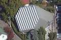
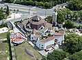
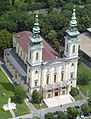
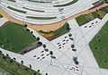
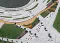
Gallery
References
 |
Wikivoyage has a travel guide for Újbuda. |
External links
Coordinates: 47°28′30″N 19°02′24″E / 47.475°N 19.04°E / 47.475; 19.04