Ópusztaszer
| Ópusztaszer | |
|---|---|
| Country |
|
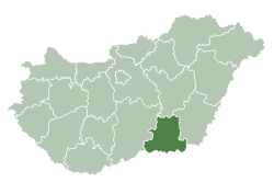
| County | Csongrád |
| Area | |
| • Total | 59.50 km2 (22.97 sq mi) |
| Population (2001) | |
| • Total | 2,290 |
| • Density | 38.5/km2 (100/sq mi) |
| Time zone | CET (UTC+1) |
| • Summer (DST) | CEST (UTC+2) |
| Postal code | 6767 |
| Area code(s) | 62 |
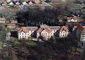
Ópusztaszer, palace from above

Location of Csongrád County in Hungary
Ópusztaszer (till 1974 Sövényháza) is a village in Csongrád county, in the Southern Great Plain region of southern Hungary. It is most known as the location of the Ópusztaszer National Heritage Park.
Geography
It covers an area of 59.5 km2 (23 sq mi) and has a population of 2290 people (2001).
External links
| Wikimedia Commons has media related to Ópusztaszer. |
| |||||||||||||||||||||
Coordinates: 46°29′N 20°05′E / 46.483°N 20.083°E