Çorovodë
| Çorovodë | |
|---|---|
| Municipality | |
|
Çorovodë in the hills of Skrapar with river Osum | |
 Çorovodë | |
| Coordinates: 40°30′N 20°13′E / 40.500°N 20.217°ECoordinates: 40°30′N 20°13′E / 40.500°N 20.217°E | |
| Country |
|
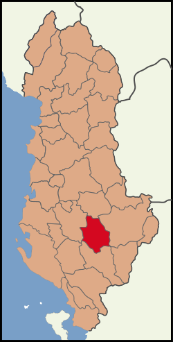
| County | Berat |
| Elevation | 300 m (1,000 ft) |
| Population (2011) | |
| • Total | 4,051 |
| Time zone | CET/CEST (UTC+1/+2) |
| Postal code | 5401-5402 |
| Area code | 0312 |
| Car plates | SK |
| Website | http://bashkiacorovode.gov.a |


Çorovodë, also written as Çorovoda is the main city of Skrapar District, Albania. The population at the 2011 census was 4,051.[1] The name of the town derives from the Slavic for "black water".
The river Osum passes through the city. Upstream it forms canyons and caves which are the highest and the longest in Albania. The river provides opportunities for kayaking and other aquatic sport.
The smaller Çorovoda River also flows through the city and mouths into the Osum river. Five km northeast of Çorovodë it formed the Gradec Canyon. In one of its cliffs the presumably biggest cave of Albania named "Pirogosh" is located. Allegedly, two kings, Piro and Goshi, named it. Also of note is the Ottoman-era Kasabashi stone bridge over the Çorovoda river.
Some archaeologists believe Çorovodë might be the oldest city in Albania. They have found ruins of some churches and a buried castle in Rovica which might be more ancient than the castle of Berat.
Notable people
- Xhelal bej Koprencka, modern Albania's founding father
- Hajredin bej Carkani, modern Albania's founding father
See Also
- Pirogoshi Cave
- Osum Canyon
References

| |||||||||||||||||||||||||||||||||||||||||||||||||
| |||||||||||||||||||||
