Zinder Airport
From Wikipedia, the free encyclopedia
| Zinder Airport | |||
|---|---|---|---|
IATA: ZND – ICAO: DRZR
 ZND | |||
| Summary | |||
| Airport type | Public | ||
| Owner | Government | ||
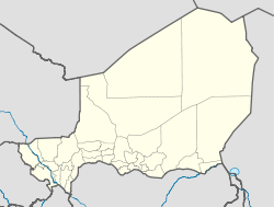
| Location | Zinder, Niger | ||
| Elevation AMSL | 1,516 ft / 462 m | ||
| Coordinates | 13°46′44″N 08°59′02″E / 13.77889°N 8.98389°ECoordinates: 13°46′44″N 08°59′02″E / 13.77889°N 8.98389°E | ||
| Runways | |||
| Direction | Length | Surface | |
| ft | m | ||
| 05/23 | 5,988 | 1,825 | Asphalt |
Zinder Airport (IATA: ZND, ICAO: DRZR) is an airport serving Zinder, Niger,[1] near the city.[citation needed]
References
- ↑ "Attributions des départements de l'ANAC." Agence nationale de l'aviation civile du Niger. Retrieved on 3 June 2013.
External links
- Airport information for DRZR at World Aero Data. Data current as of October 2006.
This article is issued from Wikipedia. The text is available under the Creative Commons Attribution/Share Alike; additional terms may apply for the media files.