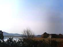
Yonago, Tottori
| Yonago 米子市 | ||
|---|---|---|
| City | ||
 | ||
| ||
 | ||
 Yonago | ||
| Coordinates: 35°26′N 133°20′E / 35.433°N 133.333°ECoordinates: 35°26′N 133°20′E / 35.433°N 133.333°E | ||
| Country | Japan | |
| Region | Chūgoku (San'in) | |
| Prefecture | Tottori Prefecture | |
| Government | ||
| • Mayor | Yasuo Nozaka (since April 2003) | |
| Area | ||
| • Total | 132.21 km2 (51.05 sq mi) | |
| Population (November 1, 2012) | ||
| • Total | 150,232 | |
| • Density | 1,136.31/km2 (2,943.0/sq mi) | |
| Time zone | Japan Standard Time (UTC+9) | |
| Symbols | ||
| - Tree | Pending | |
| - Flower | Azalea | |
| - Bird | Tundra Swan | |
| Address |
1-1 Kamo-chō, Yonago-shi, Tottori-ken 683-8686 | |
| Phone number | 0859-23-5372 | |
| Website | www.city.yonago.lg.jp | |
Yonago (米子市 Yonago-shi) is a city located in northwestern Tottori Prefecture, Japan, facing the Sea of Japan, and adjacent to Shimane. It is the prefecture's second largest city after Tottori, and forms a commercial center of the western part of this prefecture.
As of November 1, 2012, the city has an estimated population of 150,232 and a population density of 1,136.31 persons per km². The total area is 132.21 km².
The current city was administratively founded on April 1, 1927, and absorbed the town of Yodoe (from Saihaku District) on March 31, 2005. It is home to the Yonago City Museum of Art. Since the city has begun to develop into a trade center of note, it has acquired the nickname Osaka in San-in.[citation needed]
Etymology
The name of Yonago in the Japanese language is formed from two kanji characters. The first, 米, means "rice", and the second, 子 means "child".
Transportation
Yonago has always been an important crossing point of several routes in the area. Currently, it is the crosspoint of three railway lines, and has a seaport to the Oki Islands. Miho-Yonago Airport, located in a neighboring city of Sakaiminato, serves the area.
History
The Amago clan, daimyo of the Sengoku period, constructed a castle in the area at the beginning of the 17th century.[1] In the Edo period, the castle was kept by a castellan who served the Ikeda clan of nearby Tottori Castle. A city landmark is the 43-meter-tall Yumeminato Tower, located in Yumeminato-koen Park.


Climate
Yonago has a humid subtropical climate (Köppen climate classification Cfa) with hot summers and cool winters. Precipitation is significant throughout the year, with July and September being particularly wet months.
| Climate data for Yonago, Tottori | |||||||||||||
|---|---|---|---|---|---|---|---|---|---|---|---|---|---|
| Month | Jan | Feb | Mar | Apr | May | Jun | Jul | Aug | Sep | Oct | Nov | Dec | Year |
| Average high °C (°F) | 7.3 (45.1) |
7.8 (46) |
11.5 (52.7) |
17.5 (63.5) |
22.1 (71.8) |
25.0 (77) |
29.6 (85.3) |
30.9 (87.6) |
26.2 (79.2) |
21.0 (69.8) |
15.9 (60.6) |
10.7 (51.3) |
18.79 (65.83) |
| Daily mean °C (°F) | 3.8 (38.8) |
4.0 (39.2) |
6.9 (44.4) |
12.4 (54.3) |
17.1 (62.8) |
20.9 (69.6) |
25.5 (77.9) |
26.5 (79.7) |
22.0 (71.6) |
16.2 (61.2) |
11.2 (52.2) |
6.6 (43.9) |
14.42 (57.97) |
| Average low °C (°F) | 0.6 (33.1) |
0.5 (32.9) |
2.3 (36.1) |
7.2 (45) |
12.0 (53.6) |
17.1 (62.8) |
22.1 (71.8) |
22.7 (72.9) |
18.1 (64.6) |
11.6 (52.9) |
6.8 (44.2) |
2.8 (37) |
10.32 (50.58) |
| Precipitation mm (inches) | 147.8 (5.819) |
137.0 (5.394) |
125.1 (4.925) |
119.6 (4.709) |
117.1 (4.61) |
188.2 (7.409) |
244.6 (9.63) |
154.5 (6.083) |
224.7 (8.846) |
140.4 (5.528) |
132.4 (5.213) |
124.8 (4.913) |
1,856.2 (73.079) |
| Snowfall cm (inches) | 64 (25.2) |
58 (22.8) |
10 (3.9) |
0 (0) |
0 (0) |
0 (0) |
0 (0) |
0 (0) |
0 (0) |
0 (0) |
0 (0) |
24 (9.4) |
156 (61.3) |
| % humidity | 75 | 74 | 71 | 70 | 71 | 78 | 79 | 76 | 78 | 75 | 74 | 73 | 74.5 |
| Mean monthly sunshine hours | 76.6 | 88.2 | 146.5 | 182.5 | 219.5 | 177.2 | 196.5 | 221.1 | 158.6 | 160.3 | 114.3 | 89.6 | 1,830.9 |
| Source: NOAA (1961-1990) [2] | |||||||||||||
References
- ↑ "Yonago". Encyclopedia of Japan. Tokyo: Shogakukan. 2012. Retrieved 2012-04-12.
- ↑ "Yonago Climate Normals 1961-1990". National Oceanic and Atmospheric Administration. Retrieved January 5, 2013.
External links
| Wikimedia Commons has media related to Yonago, Tottori. |
- Yonago City official website (Japanese)
| ||||||||||||||||||||||
