Yocalla Municipality
From Wikipedia, the free encyclopedia
| Yocalla Municipality | |
|---|---|
| Municipality | |
 | |
 | |
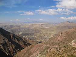
 Yocalla Municipality | |
| Coordinates: 19°23′S 65°55′W / 19.383°S 65.917°WCoordinates: 19°23′S 65°55′W / 19.383°S 65.917°W | |
| Country |
|
| Department | Potosí Department |
| Province | Tomás Frías Province |
| Seat | Yocalla |
| Population (2001) | |
| • Total | 8,046 |
| • Ethnicities | Quechua |
| Time zone | -4 (UTC-4) |
Yocalla Municipality is the second municipal section of the Tomás Frías Province in the Potosí Department in Bolivia. Its seat is Yocalla.
Subdivision
The municipality consists of the following cantons:
- Salinas de Yocalla
- Santa Lucia
- Yocalla
The people
The people are predominantly indigenous citizens of Quechua descent.[1]
| Ethnic group | % |
|---|---|
| Quechua | 93.8 |
| Aymara | 0.4 |
| Guaraní, Chiquitos, Moxos | 0.1 |
| Not indigenous | 5.7 |
| Other indigenous groups | 0.1 |
See also
- Kuntur Nasa
- Pari Chata
- Pillku Mayu
References
- ↑ obd.descentralizacion.gov.bo/municipal/fichas/ (inactive)
External links
| ||||||||||||||

This article is issued from Wikipedia. The text is available under the Creative Commons Attribution/Share Alike; additional terms may apply for the media files.