Yervandashat
Coordinates: 40°06′53″N 43°40′15″E / 40.11472°N 43.67083°E
| Yervandashat Երվանդաշատ | |
|---|---|
 | |
 Yervandashat Երվանդաշատ | |
| Coordinates: 40°06′53″N 43°40′15″E / 40.11472°N 43.67083°E | |
| Country | Armenia |
| Marz (Province) | Armavir |
| Founded | 3rd century BCE |
| Population (2001) | |
| • Total | 695 |
| Time zone | (UTC+4) |
| • Summer (DST) | (UTC+5) |
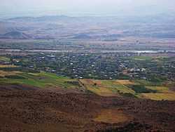
Yervandashat (Armenian: Երվանդաշատ, also Romanized as Ervandashat; also known as Kherbeklu or Kheyli-Begli) is a village in the Armavir Province of Armenia. The village has a ruined basilica dated to the 4th or 5th century and the Saint Shushanik church of the 10th to 17th century. Along the main highway leading to and from the area are khachkar monuments.
Ancient Yervandashat
Just outside of the modern village are the ruins of ancient Yervandashat, a city founded by King Orontes IV (the last of the Orontid dynasty), in the 3rd century BCE. The ancient town sits upon an escarpment overlooking the junction of the Arax River and Akhurian River. According to Movses Khorenatsi, Orontes founded Yervandashat to replace Armavir as his capital after Armavir had been left dry by a shift of the Arax. The archaeological site has not been subject of major research, but preliminarily, the fortifications and some remains of palaces have been uncovered.
Ancient Yervandashat was destroyed by the army of the Persian King Shapur II in the 360s.
References
- '32FA881E678D3774E0440003BA962ED3'&Diacritics=DC Yervandashat at GEOnet Names Server
- The Kingdom of Armenia By Mack Chahin
- History of Armenia, by Moses of Chorene
- Report of the results of the 2001 Armenian Census, National Statistical Service of the Republic of Armenia
- Brady Kiesling, Rediscovering Armenia, p. 39; original archived at Archive.org, and current version online on Armeniapedia.org.
External links
| Wikimedia Commons has media related to Yervandashat. |
| |||||
