Wolayita Zone
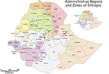
Wolayita is a Zone in the Ethiopian Southern Nations, Nationalities and Peoples Region (SNNPR). it is named for the Welayta people, whose homeland lies in this Zone. Wolayita is bordered on the south by Gamo Gofa, on the west by the Omo River which separates it from Dawro, on the northwest by Kembata Tembaro, on the north by Hadiya, on the northeast by the Oromia Region, on the east by the Bilate River which separates it from Sidama, and on the south east by the Lake Abaya which separates it from Oromia Region. The administrative center of Wolayita is Sodo.
Wolayita has 358 kilometers of all-weather roads and 425 kilometers of dry-weather roads, for an average road density of 187 kilometers per 1000 square kilometers.[1] The highest point in this Zone is Mount Damota (2738 meters).
Originally Wolayita was part of the Semien (North) Omo Zone, and the 1994 national census counted its inhabitants as part of that Zone. However friction between the various ethnic groups in Semien Omo, which was often blamed on the Welayta for "ethnic chauvinism" and despite the efforts of the ruling party to emphasize the need to co-ordinate, consolidate, and unify the smaller ethnic units to achieve the "efficient use of scarce government resources", eventually led to the division of the Zone in 2000, resulting with the creation of not only the Wolayita, but also the Gamo Gofa and Dawro Zones and two special woredas.[2]
Demographics
Based on the 2007 Census conducted by the Central Statistical Agency of Ethiopia (CSA), this Zone has a total population of 1,501,112, of whom 739,533 are men and 761,579 women; with an area of 4,208.64 square kilometers, Wolayita has a population density of 356.67. While 172,514 or 11.49% are urban inhabitants, a further 1,196 or 0.08% are pastoralists. A total of 310,454 households were counted in this Zone, which results in an average of 4.84 persons to a household, and 297,981 housing units. The largest ethnic group reported in this Zone is the Welayta (96.31%); all other ethnic groups made up 3.69% of the population. Welayta is spoken as a first language by 96.82% of the inhabitants; the remaining 3.18% spoke all other primary languages reported. 71.34% were Protestants, 21% of the population said they practiced Ethiopian Orthodox Christianity, and 5.35% embraced Catholicism.[3]
References
- ↑ "Detailed statistics on roads", SNNPR Bureau of Finance and Economic Development website (accessed 3 September 2009)
- ↑ Sarah Vaughan, "Ethnicity and Power in Ethiopia" (University of Edinburgh: Ph.D. Thesis, 2003), pp. 251 - 260
- ↑ Census 2007 Tables: Southern Peoples, Nations and Nationalities Region, Tables 2.1, 2.4, 2.5, 3.1, 3.2 and 3.4.
Coordinates: 6°50′N 37°45′E / 6.833°N 37.750°E
| |||||||||||||

| |||||||