Winseler
From Wikipedia, the free encyclopedia
| Winseler Wanseler | ||
|---|---|---|
| Commune | ||
 | ||
| ||
 | ||
| Country |
| |
| District | Diekirch | |
| Canton | Wiltz | |
| Government | ||
| • Mayor | Romain Schroeder | |
| Area | ||
| • Total | 30.42 km2 (11.75 sq mi) | |
| Area rank | 18th of 116 | |
| Highest elevation | 520 m (1,710 ft) | |
| • Rank | 17th of 116 | |
| Lowest elevation | 320 m (1,050 ft) | |
| • Rank | 112th of 116 | |
| Population (2011) | ||
| • Total | 1,087 | |
| • Rank | 94th of 116 | |
| • Density | 36/km2 (93/sq mi) | |
| • Density rank | 108th of 116 | |
| Time zone | CET (UTC+1) | |
| • Summer (DST) | CEST (UTC+2) | |
| LAU 2 | LU00005011 | |
| Website | winseler.lu | |
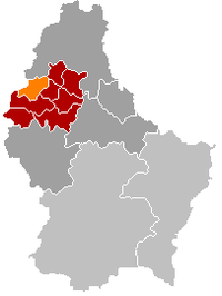
Winseler (Luxembourgish: Wanseler) is a commune and village in north-western Luxembourg.
Administrative organization and population
It is part of the canton of Wiltz, which is part of the district of Diekirch.
As of 2005, the village of Winseler, which lies in the east of the commune, has a population of 120.
Other towns within the commune
Other towns within the commune include Berlé, Doncols, Noertrange, and Sonlez.
Linguistic background
Like Lasauvage in the south of Luxembourg, Doncols and Sonlez, were formerly known as French-speaking (or, strictly, in their cases, Walloon-speaking) villages.
See also
- Doncols#Historical and linguistic backgrounds
| Wikimedia Commons has media related to Winseler. |
| |||||||
Coordinates: 49°58′N 5°53′E / 49.967°N 5.883°E
This article is issued from Wikipedia. The text is available under the Creative Commons Attribution/Share Alike; additional terms may apply for the media files.

