Wila Qullu (Challapata)
From Wikipedia, the free encyclopedia
| Wila Qullu | |
|---|---|
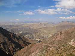 Cordillera de los Frailes, looking west. Pari Chata is on the right in the background, left of it is the Pillku Mayu valley. Wila Qullu is visible in the distance (to the right beside Parichata). | |
| Elevation | 5,144 m (16,877 ft)[1] |
| Location | |
 Wila Qullu | |
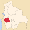
| Location | Bolivia, Oruro Department, Challapata Province |
| Range | Andes |
| Coordinates | 19°5′S 66°20′W / 19.083°S 66.333°WCoordinates: 19°5′S 66°20′W / 19.083°S 66.333°W[2] |
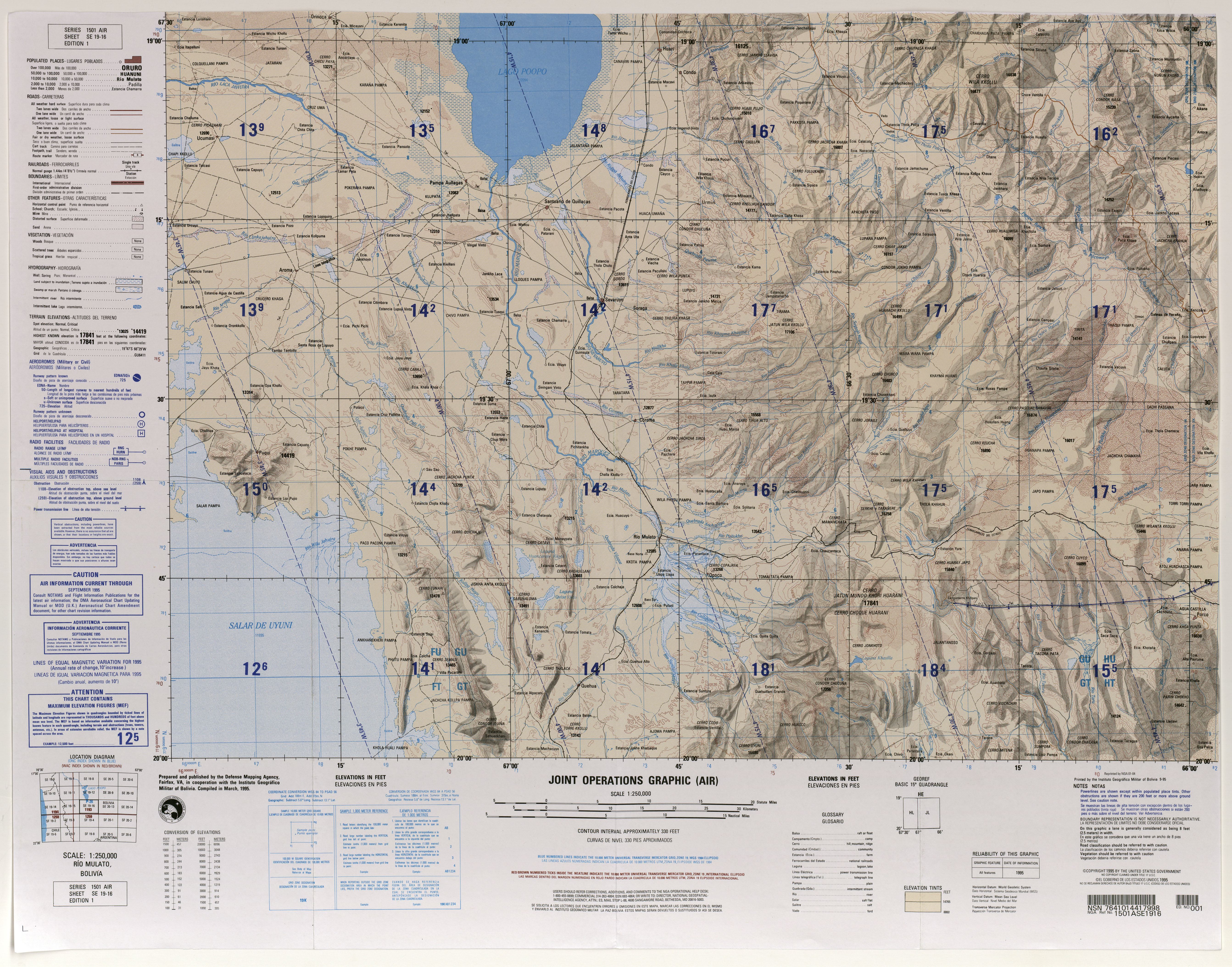
Wila Qullu (Aymara wila red or blood, qullu mountain,[3] "red mountain", hispanicized spelling Wila Kkollu, Wila Kollu) is a mountain in the Andes in Bolivia, about 5,144 m (16,877 ft) high. It is located in the Oruro Department, Challapata Province, Challapata Municipality,[4] south of Jach'a River and north of Nacional Route 1.
The Jach'a Juqhu River which is considered to be the origin of the Pillku Mayu flows along the southern slopes of the mountain.
See also
References
- ↑ lib.utexas.edu Map showing "Wila Kkollu" (16,877 ft)
- ↑ "Cerro Wila Kollu". mapcarta.com. Retrieved 2012-12-23.
- ↑ www.katari.org Aymara-Spanish dictionary: Wila (s.) - Sangre. adj. Color rojo Qullu (s.) - Cerro. Montón de algo.
- ↑ Challapata Municipality: population data and map showing Jach'a River ("Río Jachcha"). Wila Qullu (unnamed) lies south of it and north of National Route 1 (red line).
| ||||||||||||||
This article is issued from Wikipedia. The text is available under the Creative Commons Attribution/Share Alike; additional terms may apply for the media files.