Weston Aqueduct
From Wikipedia, the free encyclopedia
|
Weston Aqueduct Linear District | |
 | |
|
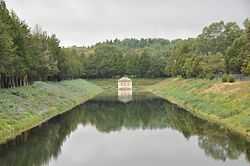
The channel chamber house and open channel leading to the Weston Reservoir | |
 | |
| Location | Southborough, Framingham, Wayland, and Weston |
|---|---|
| Coordinates | 42°20′0″N 71°22′32″W / 42.33333°N 71.37556°WCoordinates: 42°20′0″N 71°22′32″W / 42.33333°N 71.37556°W |
| Architect | Stearns, Frederick P.; et al. |
| Architectural style | Renaissance |
| Governing body | Local |
| MPS | Water Supply System of Metropolitan Boston MPS |
| NRHP Reference # | 89002274[1] |
| Added to NRHP | January 18, 1990 |
The Weston Aqueduct is an aqueduct operated by the Massachusetts Water Resources Authority. Now part of the MWRA backup systems, it was designed to deliver water from the Sudbury Reservoir in Framingham to the Weston Reservoir in Weston. The 13.5-mile (21.7 km) aqueduct begins at the Sudbury Dam, and passes through the towns of Southborough, Framingham, Wayland, and Weston.
In 1990 the route, buildings and bridges of the aqueduct were added to the National Register of Historic Places as the Weston Aqueduct Linear District.
References
| Wikimedia Commons has media related to Weston Aqueduct. |
- ↑ "National Register Information System". National Register of Historic Places. National Park Service. 2008-04-15.
| ||||||||||||||||||||||||||||||||||||||||
This article is issued from Wikipedia. The text is available under the Creative Commons Attribution/Share Alike; additional terms may apply for the media files.
