West Driefontein
From Wikipedia, the free encyclopedia
| West Driefontein | |
|---|---|
 West Driefontein | |
| Coordinates: 26°23′S 27°26′E / 26.383°S 27.433°ECoordinates: 26°23′S 27°26′E / 26.383°S 27.433°E | |
| Country | South Africa |
| Province | Gauteng |
| District | West Rand |
| Municipality | Merafong City |
| Area[1] | |
| • Total | 47.54 km2 (18.36 sq mi) |
| Population (2011)[1] | |
| • Total | 2,857 |
| • Density | 60/km2 (160/sq mi) |
| Racial makeup (2011)[1] | |
| • Black African | 97.1% |
| • Coloured | 1.3% |
| • Indian/Asian | 0.4% |
| • White | 1.2% |
| First languages (2011)[1] | |
| • Sotho | 28.4% |
| • Xhosa | 27.2% |
| • Tsonga | 15.0% |
| • Zulu | 13.8% |
| • Other | 15.6% |
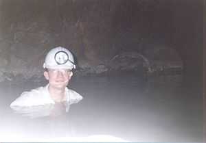
Flooded level, West Driefontein mine, South Africa. The dolomite overlying the gold reefs hosts much groundwater, giving the mines flooding problems.
West Driefontein is a small mining town approximately 10 kilometres (6.2 mi) outside Carletonville next to Blyvooruitsig and East Driefontein.
References
- ↑ 1.0 1.1 1.2 1.3 "Main Place West Driefontein". Census 2011.
| ||||||||||||||||||||
.svg.png)
This article is issued from Wikipedia. The text is available under the Creative Commons Attribution/Share Alike; additional terms may apply for the media files.