Weiding
From Wikipedia, the free encyclopedia
For Weiding in the district of Schwandorf, see Weiding, Schwandorf.
| Weiding | ||
|---|---|---|
| ||
 Weiding | ||
Location of Weiding within Cham district 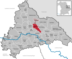 | ||
| Coordinates: 49°16′N 12°46′E / 49.267°N 12.767°ECoordinates: 49°16′N 12°46′E / 49.267°N 12.767°E | ||
| Country | Germany | |
| State | Bavaria | |
| Admin. region | Oberpfalz | |
| District | Cham | |
| Municipal assoc. | Weiding | |
| Subdivisions | 14 Ortsteile | |
| Government | ||
| • Mayor | Karl Holmeier | |
| Area | ||
| • Total | 28.16 km2 (10.87 sq mi) | |
| Elevation | 380 m (1,250 ft) | |
| Population (2012-12-31)[1] | ||
| • Total | 2,478 | |
| • Density | 88/km2 (230/sq mi) | |
| Time zone | CET/CEST (UTC+1/+2) | |
| Postal codes | 93495 | |
| Dialling codes | 09977 | |
| Vehicle registration | CHA | |
| Website | www.weiding.de | |

Weiding is a municipality in the district of Cham in Bavaria in Germany.
References
- ↑ "Fortschreibung des Bevölkerungsstandes". Bayerisches Landesamt für Statistik und Datenverarbeitung (in German). 31 December 2012.
This article is issued from Wikipedia. The text is available under the Creative Commons Attribution/Share Alike; additional terms may apply for the media files.