Waverly, Ohio
| Waverly, Ohio Waverly City, Ohio | |
|---|---|
| Village | |
| Motto: "Working for a Vibrant Future" | |
 | |
 | |
| Coordinates: 39°7′34″N 82°58′59″W / 39.12611°N 82.98306°WCoordinates: 39°7′34″N 82°58′59″W / 39.12611°N 82.98306°W | |
| Country | United States |
| State | Ohio |
| County | Pike |
| Government | |
| • Mayor | Greg Kempton |
| Area[1] | |
| • Total | 4.26 sq mi (11.03 km2) |
| • Land | 4.20 sq mi (10.88 km2) |
| • Water | 0.06 sq mi (0.16 km2) |
| Population (2010)[2] | |
| • Total | 4,408 |
| • Estimate (2011[3]) | 4,395 |
| • Density | 1,049.5/sq mi (405.2/km2) |
| Time zone | Eastern (EST) (UTC-5) |
| • Summer (DST) | EDT (UTC-4) |
| ZIP code | 45690 |
| Area code(s) | 740 Exchanges: 941,947 |
| Website | http://www.cityofwaverly.net/ |
Waverly (also Waverly City) is a village in, and the county seat of, Pike County, Ohio, United States.[4] The population was 4,408 at the 2010 census. The town was formed in 1829, as the construction of the Ohio and Erie Canal along the west bank of the Scioto River brought new growth to the area. In 1861 the county seat was moved here from Piketon.
Waverly is served by the Garnet A. Wilson Public Library. The current Mayor is Greg Kempton.
Gallery
-
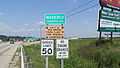
Waverly corporation limit sign.
-
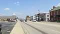
Looking east on Emmitt Avenue (U.S. Highway 23) in Waverly.
History
Waverly was platted circa 1829 by a M. Downing, and by 1840, it had 306 inhabitants. In the mid-1840s, the community included two churches — Presbyterian and Methodist — and four stores.[5]
Waverly was a "sundown town",[6] a town founded with the express purpose of being an all-white town.[7] In its early days, a sign on the outskirts of town warned black people to stay out after dark.[7] In an 1884 history of the area, an anonymous author wrote that "Waverly’s not having a single colored resident is a rare mark of distinction for a town of its size."[6] The author also wrote that Waverly had never had "a Negro or mulatto resident."[6] Waverly was one of the few "sundown towns" that existed before the Civil War.[6]
The historic Emmitt House burned down on January 6th, 2014.
Geography
Waverly is located at 39°7′34″N 82°58′59″W / 39.12611°N 82.98306°W (39.126181, -82.983173).[8]
According to the United States Census Bureau, the city has a total area of 4.26 square miles (11.03 km2), of which 4.20 square miles (10.88 km2) is land and 0.06 square miles (0.16 km2) is water.[1]
Demographics
2010 census
As of the census[2] of 2010, there were 4,408 people, 2,035 households, and 1,142 families residing in the city. The population density was 1,049.5 inhabitants per square mile (405.2 /km2). There were 2,290 housing units at an average density of 545.2 per square mile (210.5 /km2). The racial makeup of the city was 96.2% White, 1.0% African American, 0.3% Native American, 0.4% Asian, 0.4% from other races, and 1.6% from two or more races. Hispanic or Latino of any race were 0.8% of the population.
There were 2,035 households of which 24.4% had children under the age of 18 living with them, 37.9% were married couples living together, 13.5% had a female householder with no husband present, 4.8% had a male householder with no wife present, and 43.9% were non-families. 40.2% of all households were made up of individuals and 23.2% had someone living alone who was 65 years of age or older. The average household size was 2.10 and the average family size was 2.75.
The median age in the city was 48 years. 19.5% of residents were under the age of 18; 7.1% were between the ages of 18 and 24; 19% were from 25 to 44; 26.6% were from 45 to 64; and 27.8% were 65 years of age or older. The gender makeup of the city was 46.6% male and 53.4% female.
2000 census
As of the census of 2000, there were 4,433 people, 2,028 households, and 1,237 families residing in the village. The population density was 1,131.3 people per square mile (436.6/km²). There were 2,219 housing units at an average density of 566.3 per square mile (218.6/km²). The racial makeup of the village was 96.75% White, 1.15% African American, 0.59% Native American, 0.54% Asian, 0.05% Pacific Islander, 0.02% from other races, and 0.90% from two or more races. Hispanic or Latino of any race were 0.38% of the population.
There were 2,028 households out of which 23.8% had children under the age of 18 living with them, 46.4% were married couples living together, 11.4% had a female householder with no husband present, and 39.0% were non-families. 35.9% of all households were made up of individuals and 22.7% had someone living alone who was 65 years of age or older. The average household size was 2.15 and the average family size was 2.76.
In the village the population was spread out with 20.7% under the age of 18, 7.3% from 18 to 24, 24.0% from 25 to 44, 18.2% from 45 to 64, and 29.8% who were 65 years of age or older. The median age was 43 years. For every 100 females there were 80.4 males. For every 100 females age 18 and over, there were 75.8 males.
The median income for a household in the village was $33,895, and the median income for a family was $41,346. Males had a median income of $38,045 versus $20,972 for females. The per capita income for the village was $18,554. About 9.1% of families and 12.2% of the population were below the poverty line, including 13.9% of those under the age of 18 and 9.1% ages 65 or older.
References
- ↑ 1.0 1.1 "US Gazetteer files 2010". United States Census Bureau. Retrieved 2013-01-06.
- ↑ 2.0 2.1 "American FactFinder". United States Census Bureau. Retrieved 2013-01-06.
- ↑ "Population Estimates". United States Census Bureau. Retrieved 2013-01-06.
- ↑ "Find a County". National Association of Counties. Retrieved 2011-06-07.
- ↑ Howe, Henry. Historical Collections of Ohio Vol. 2. 1908 ed. Columbus: State of Ohio, 1908, 424.
- ↑ 6.0 6.1 6.2 6.3 Loewen, James W. (2005). Sundown Towns: A Hidden Dimension of American Racism. The New Press. pp. Page 9 in linked PDF. ISBN 9781565848870.
- ↑ 7.0 7.1 Olkowski, Lu (2 July 2013). "Ally's Choice (podcast)". WNYC. Retrieved 3 July 2013.
- ↑ "US Gazetteer files: 2010, 2000, and 1990". United States Census Bureau. 2011-02-12. Retrieved 2011-04-23.
External links
| Wikimedia Commons has media related to Waverly, Ohio. |
- Waverly Police Department
- Pike County Sheriff's Office
- Garnet A. Wilson Public Library
- Village of Waverly Web site
- Waverly Ohio information
| ||||||||||||||||||||
