Waverly, Baltimore
.jpg)
Waverly is a historic village in Baltimore, Maryland, United States. Located near I-83, York Road and major bus connections, Waverly provides access to downtown Baltimore, Towson, and the Baltimore Beltway. Waverly is middle-class neighborhood.[citation needed]
Subdivisions

Waverly has two sub-divisions.
The area known as Waverly (-north) has Greenmount Avenue as its western border, 39th Street as its northern border, Ellerslie as its eastern border, and 33rd Street as its southern border. The community association for this area is called the WIA, or "Waverly Improvement Association."
The area known as "Better Waverly" (from the Olde English term meaning "greater" or "larger") occupies the area east of Greenmount Avenue, south of 33rd Street, north of 25th Street, and west of Loch Raven Boulevard.
History
Baltimore schoolteacher and poet Lizette Woodworth Reese's Waverly, A Victorian Village uses poetry and anecdotal prose to depict the neighborhood around the start of the 20th century. The frontispiece from this volume, a woodcut of a fruit tree, can be seen at the entrance to the Waverly branch public library.
Another notable Waverly resident was Major Venable, a lawyer who wrote a standard legal textbook and dedicated much of his personal time to improving Baltimore's public parks. Venable Street is named after him (Baltimore Sun).
The trolley line "Waverly to downtown" was the first in the United States.[citation needed]
This neighborhood was the home of Memorial Stadium, where the Baltimore Colts and the Baltimore Orioles played. The stadium was torn down and replaced with Memorial Place, housing for senior citizens.
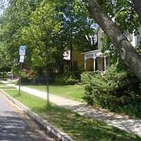
Architecture is primarily row houses and wood Victorian single-family homes. Some of the latter are in a historic district designated by the city's Center for Historic and Architectural Preservation.[1]
Notes
External links
Coordinates: 39°19′56″N 76°36′24″W / 39.33222°N 76.60667°W