Washington, West Virginia
| Washington, West Virginia | |
|---|---|
| CDP | |
 | |
| Coordinates: 39°14′17″N 81°40′14″W / 39.23806°N 81.67056°WCoordinates: 39°14′17″N 81°40′14″W / 39.23806°N 81.67056°W | |
| Country | United States |
| State | West Virginia |
| County | Wood |
| Area[1] | |
| • Total | 4.4 sq mi (11.3 km2) |
| • Land | 4.2 sq mi (10.8 km2) |
| • Water | 0.2 sq mi (0.6 km2) |
| Elevation | 643 ft (196 m) |
| Population (2010)[2] | |
| • Total | 1,175 |
| • Density | 270/sq mi (100/km2) |
| Time zone | Eastern (EST) (UTC-5) |
| • Summer (DST) | EDT (UTC-4) |
| ZIP code | 26181 |
| Area code(s) | 304 |
| FIPS code | 54-84724[3] |
| GNIS feature ID | 1548816[4] |
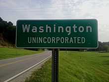
Washington is a census-designated place (CDP) in Wood County, West Virginia, along the Ohio River. It is part of the Parkersburg-Marietta-Vienna, WV-OH Metropolitan Statistical Area. The population was 1,175 at the 2010 census.[2]
The CDP is home to the Washington Works, one of the largest single facilities of chemicals manufacturing giant DuPont.
Also home to Sabic Plastics Washington Works. (previously GE Plastics, acquired from Borg Warner Plastics, née Marbon)
Geography
Washington is located at 39°14′17″N 81°40′14″W / 39.23806°N 81.67056°W (39.237991, -81.670477)[1].
According to the United States Census Bureau, the CDP has a total area of 4.4 square miles (11.3 km²), of which 4.2 square miles (10.8 km²) is land and 0.2 square mile (0.6 km²) (5.13%) is water.
Demographics

As of the census[3] of 2000, there were 1,170 people, 466 households, and 376 families residing in the community. The population density was 275.6 people per square mile (106.3/km²). There were 518 housing units at an average density of 122.0/sq mi (47.1/km²). The racial makeup of the community was 98.21% White, 0.17% African American, 0.60% Native American, 0.43% Asian, and 0.60% from two or more races.
There were 466 households out of which 32.8% had children under the age of 18 living with them, 73.0% were married couples living together, 4.9% had a female householder with no husband present, and 19.1% were non-families. 16.7% of all households were made up of individuals and 4.9% had someone living alone who was 65 years of age or older. The average household size was 2.51 and the average family size was 2.81.
The age distribution is 23.6% under the age of 18, 4.7% from 18 to 24, 26.8% from 25 to 44, 33.8% from 45 to 64, and 11.2% who were 65 years of age or older. The median age was 42 years. For every 100 females there were 106.3 males. For every 100 females age 18 and over, there were 100.0 males.
The median income for a household in the community was $54,483, and the median income for a community is $60,000. Males had a median income of $48,036 versus $24,712 for females. The per capita income for the CDP was $25,209. About 2.1% of families and 2.3% of the population were below the poverty line, including 3.4% of those under age 18 and 5.1% of those age 65 or over.
See also
- List of cities and towns along the Ohio River
References
- ↑ 1.0 1.1 "US Gazetteer files: 2010, 2000, and 1990". United States Census Bureau. 2011-02-12. Retrieved 2011-04-23.
- ↑ 2.0 2.1 "American FactFinder". United States Census Bureau. Retrieved 2011-05-14.
- ↑ 3.0 3.1 "American FactFinder". United States Census Bureau. Retrieved 2008-01-31.
- ↑ "US Board on Geographic Names". United States Geological Survey. 2007-10-25. Retrieved 2008-01-31.
