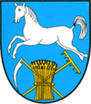
Warszowice
From Wikipedia, the free encyclopedia
| Warszowice | ||
|---|---|---|
| Village | ||
| ||
 Warszowice | ||
| Coordinates: 50°0′N 18°43′E / 50.000°N 18.717°E | ||
| Country |
| |
| Voivodeship | Silesian | |
| County | Pszczyna | |
| Gmina | Pawłowice | |
| Area | 14.82 km2 (5.72 sq mi) | |
| Population | 1,795 | |
| • Density | 120/km2 (310/sq mi) | |
Warszowice [varʂɔˈvit͡sɛ] is a village in the administrative district of Gmina Pawłowice, within Pszczyna County, Silesian Voivodeship, in southern Poland.[1] It lies approximately 17 kilometres (11 mi) west of Pszczyna and 35 km (22 mi) south-west of the regional capital Katowice.
The village has a population of 1,795.
References
- ↑ "Central Statistical Office (GUS) - TERYT (National Register of Territorial Land Apportionment Journal)" (in Polish). 1 June 2008.
| Wikimedia Commons has media related to Warszowice. |
| ||||||||||
Coordinates: 50°0′N 18°43′E / 50.000°N 18.717°E
This article is issued from Wikipedia. The text is available under the Creative Commons Attribution/Share Alike; additional terms may apply for the media files.

