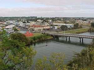
Waitara River

The river once had a dock in Waitara, where export meat from the town's Thos. Borthwick & Sons freezing-works was loaded onto ships. However this trade is now conducted from New Plymouth's Port Taranaki. The river is also prone to flooding, and there are stop banks (levees) to the west of the river (upstream from the bridge) and on both sides downstream.
The Waitara is the first mud-bottomed river to the north of Cape Egmont.
The historic Bertrand Road suspension bridge, (one of only a few such road bridges in New Zealand) is several kilometres from State Highway 3 (just up from the town).
New Zealand Wars
In December 1860 during the First Taranaki War campaign of the New Zealand Wars, British forces under Major-General Pratt carried out sapping operations against a major Māori defensive line called Te Arei ("The barrier") on the west side of the Waitara River, which was barring the way to the historic hill pā of Pukewairangi. During this operation, Colour Serjeant John Lucas was awarded the Victoria Cross on 18 March 1861.
References
- ↑ Wright-Taylor, Thomas Ludovic. "'WAITARA RIVER' from An Encyclopaedia of New Zealand, edited by A.H. McLintock, originally published in 1966. Te Ara - The Encyclopaedia of New Zealand, updated 18-Sep-2007". Retrieved 2007-12-31.
Coordinates: 38°59′S 174°14′E / 38.983°S 174.233°E